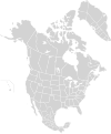
File:North America second level political division 2 and Greenland.svg
Appearance

Size of this PNG preview of this SVG file: 498 × 600 pixels. Other resolutions: 199 × 240 pixels | 399 × 480 pixels | 638 × 768 pixels | 850 × 1,024 pixels | 1,701 × 2,048 pixels | 1,789 × 2,154 pixels.
Original file (SVG file, nominally 1,789 × 2,154 pixels, file size: 367 KB)
File history
Click on a date/time to view the file as it appeared at that time.
| Date/Time | Thumbnail | Dimensions | User | Comment | |
|---|---|---|---|---|---|
| current | 13:57, 18 March 2008 |  | 1,789 × 2,154 (367 KB) | CarolSpears | minor validation problems repaired |
| 13:41, 18 March 2008 |  | 1,789 × 2,154 (367 KB) | CarolSpears | {{Information |Description={{en|Map of North America and its second-level political divisions. Canadian provinces, US and Mexican states. Canada, Mexico, United States. Non-contiguous parts of a states/provinces are "grouped" together with the main area |
File usage
The following 5 pages use this file:
Global file usage
The following other wikis use this file:
- Usage on es.wikipedia.org
