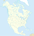
File:North America map with states and provinces.svg
Appearance

Size of this PNG preview of this SVG file: 576 × 599 pixels. Other resolutions: 231 × 240 pixels | 461 × 480 pixels | 738 × 768 pixels | 984 × 1,024 pixels | 1,968 × 2,048 pixels | 1,300 × 1,353 pixels.
Original file (SVG file, nominally 1,300 × 1,353 pixels, file size: 674 KB)
File history
Click on a date/time to view the file as it appeared at that time.
| Date/Time | Thumbnail | Dimensions | User | Comment | |
|---|---|---|---|---|---|
| current | 22:28, 24 May 2019 |  | 1,300 × 1,353 (674 KB) | Kaldari | User created page with UploadWizard |
File usage
The following page uses this file:
Global file usage
The following other wikis use this file:
- Usage on br.wikipedia.org
- Usage on en.wiktionary.org
- Kanada
- Amerika
- Grönland
- الولايات المتحدة
- Amerika Birleşik Devletleri
- Meksika
- Küba
- Atlas Okyanusu
- كندا
- امریکا
- كوبا
- جرينلاند
- Náhookǫsjí Kéyah dah siʼánígíí
- Bắc Mĩ
- المكسيك
- کینیڈا
- Kebek
- Wiktionary:Picture dictionary/ajp:map/North America
- أميركا الشمالية
- Wiktionary:Picture dictionary/ur:map/North America
- Wiktionary:Picture dictionary/vi:map/North America
- Wiktionary:Picture dictionary/tr:map/North America
- Wiktionary:Picture dictionary/hi:map/North America
- Wiktionary:Picture dictionary/nv:map/North America
- Usage on hu.wiktionary.org
- Usage on zh.wiktionary.org
