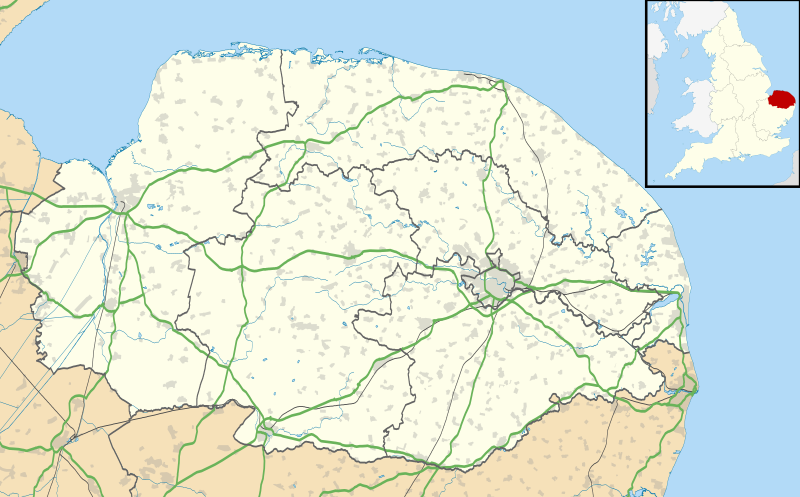
File:Norfolk UK location map.svg
Appearance

Size of this PNG preview of this SVG file: 800 × 497 pixels. Other resolutions: 320 × 199 pixels | 640 × 398 pixels | 1,024 × 637 pixels | 1,280 × 796 pixels | 2,560 × 1,592 pixels | 1,425 × 886 pixels.
Original file (SVG file, nominally 1,425 × 886 pixels, file size: 1.93 MB)
File history
Click on a date/time to view the file as it appeared at that time.
| Date/Time | Thumbnail | Dimensions | User | Comment | |
|---|---|---|---|---|---|
| current | 19:05, 26 September 2010 |  | 1,425 × 886 (1.93 MB) | Nilfanion | {{Information |Description=Map of Norfolk, UK with the following information shown: *Administrative borders *Coastline, lakes and rivers *Roads and railways *Urban areas Equirectangular map projection on WGS 84 datum, with N/S stretched 160 |
File usage
More than 100 pages use this file. The following list shows the first 100 pages that use this file only. A full list is available.
- Acle
- Arminghall
- Attleborough
- Aylsham
- Baconsthorpe Castle
- Bacton, Norfolk
- Barton Turf
- Beeston, Norfolk
- Belaugh
- Blakeney, Norfolk
- Blickling Hall
- Bradwell, Norfolk
- Brumstead
- Burgh Castle
- Burnham Thorpe
- Buxton, Norfolk
- Caister-on-Sea
- Cantley, Norfolk
- Castle Acre Priory
- Castle Rising Castle
- Cley next the Sea
- Coltishall
- Costessey
- Cromer
- Denton, Norfolk
- Denver, Norfolk
- Dereham
- Dilham
- Diss, Norfolk
- Ditchingham
- Downham Market
- Earlham Road
- East Ruston
- Fakenham
- Gorleston-on-Sea
- Great Yarmouth
- Halvergate
- Halvergate Marshes
- Holkham
- Holme-next-the-Sea
- Holt, Norfolk
- Hopton-on-Sea
- Horning
- Hoveton
- Hunstanton
- Ingham, Norfolk
- Irstead
- James Paget University Hospital
- Kettlestone
- King's Lynn
- Loddon, Norfolk
- Ludham
- Marham
- Martham
- Melton Constable
- Morston
- Neatishead
- North Elmham
- North Walsham
- Norwich Airport
- Norwich Castle
- Old Catton
- Overstrand
- Ovington, Norfolk
- Potter Heigham
- RAF Coltishall
- RAF Marham
- RAF West Raynham
- RRH Neatishead
- Ranworth
- Reedham, Norfolk
- Salhouse
- Sandringham, Norfolk
- Scoulton
- Sculthorpe Training Area
- Shelfanger
- Sheringham
- Sheringham Park
- Snettisham
- South Walsham
- Sprowston
- St Benet's Abbey
- St Olaves
- Stalham
- Stiffkey
- Strumpshaw
- Swaffham
- Taverham
- Thetford
- Thurne
- Trimingham
- Upton, Norfolk
- Walcott, Norfolk
- Walsingham
- Wayford Bridge
- Wells-next-the-Sea
- Welney
- West Dereham
- Woodbastwick
- Worstead
View more links to this file.
Global file usage
The following other wikis use this file:
- Usage on af.wikipedia.org
- Usage on ar.wikipedia.org
- Usage on bg.wikipedia.org
- Usage on ceb.wikipedia.org
- Usage on cs.wikipedia.org
- Usage on es.wikipedia.org
- Norwich
- King's Lynn
- Sandringham
- Aeropuerto Internacional de Norwich
- Plantilla:Mapa de localización de Norfolk
- Boughton (Norfolk)
- Ashby with Oby
- Belton with Browston
- Bradwell (Norfolk)
- Burgh Castle (pueblo)
- Caister-on-Sea
- Filby
- Fleggburgh
- Fritton and St. Olaves
- Hemsby
- Hopton-on-Sea
- Martham
- Mautby
- Ormesby St. Margaret with Scratby
- Repps with Bastwick
- Ormesby St. Michael
- Rollesby
- Somerton (Norfolk)
- Stokesby with Herringby
- Thurne
- West Caister
- Winterton-on-Sea
- Ashill (Norfolk)
- Attleborough (Norfolk)
- Banham
- Bawdeswell
- Whinburgh and Westfield
- Beachamwell
- Wood Dalling
- Woodbastwick
- Aldborough (Norfolk)
- Beeston Regis
View more global usage of this file.
