Jump to content

File:Noahsworld map.png

Page contents not supported in other languages.
This is a file from the Wikimedia Commons
From Wikipedia, the free encyclopedia

Original file (800 × 1,192 pixels, file size: 337 KB, MIME type: image/png)

Description
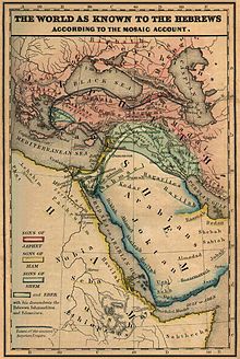
English: The world as known to the Hebrews. A map from "Historical Textbook and Atlas of Biblical Geography (1854)" by Lyman Coleman
Date
Source
  • Μap from "Historical Textbook and Atlas of Biblical Geography (1854)" by Lyman Coleman
  • Historical Origins by Robert Shaw,2003,ISBN -0766149781
  • The western paradise: Greek and Hebrew traditions by James E. Miller,1996,
  • The International Standard Bible Encyclopedia: Q-Z, by Geoffrey W. Bromiley
  • The Bible Knowledge Commentary: Old Testament by John F. Walvoord,Roy B. Zuck,1985,ISBN -0882078135
  • The International Standard Bible Encyclopedia: Q-Z, by Geoffrey W. Bromiley,1995
ISBN -0802837840
Author

Megistias

Lyman Coleman  (1796–1882)  wikidata:Q20856065
 
Lyman Coleman
Description American academic and author
Date of birth/death 14 June 1796 Edit this at Wikidata 16 March 1882 Edit this at Wikidata
Authority file
creator QS:P170,Q20856065
Permission
(Reusing this file)
Public domain I, the copyright holder of this work, release this work into the public domain. This applies worldwide.
In some countries this may not be legally possible; if so:
I grant anyone the right to use this work for any purpose, without any conditions, unless such conditions are required by law.
Other versions This map derives from a 1854 map
1854 original map
, below that is another version,

Captions

Add a one-line explanation of what this file represents

Items portrayed in this file

depicts

19 February 2010

image/png

344,778 byte

1,192 pixel

800 pixel

4542d8e2b1dfb704a882d5dd16d0fabe759fe21a

File history

Click on a date/time to view the file as it appeared at that time.

Date/TimeThumbnailDimensionsUserComment
current20:18, 19 February 2010Thumbnail for version as of 20:18, 19 February 2010800 × 1,192 (337 KB)MegistiasAdded, Zidon, Zoar, Arpad, Aram, Arphachsad, Mash, Carchemish, Calneh, (Armenians) parentheses in Medians. Ludim, Amalek, Edom, Midian and Sinim. Kaspian, Kur R.,
14:40, 19 February 2010Thumbnail for version as of 14:40, 19 February 2010800 × 1,192 (331 KB)Megistias{{Information |Description={{en|The World as known to the Hebrews. A map from Historical Textbook and Atlas of Biblical Geography (1854) by Coleman}} |Source= *map from Historical Textbook and Atlas of Biblical Geography (1854) by Coleman *Historical Orig

Global file usage

The following other wikis use this file: