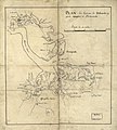
File:Newport News 1800 map imageCA8Q5H1A.jpg
Appearance

Size of this preview: 539 × 599 pixels. Other resolutions: 216 × 240 pixels | 432 × 480 pixels | 691 × 768 pixels | 921 × 1,024 pixels | 1,842 × 2,048 pixels | 3,684 × 4,095 pixels.
Original file (3,684 × 4,095 pixels, file size: 1.84 MB, MIME type: image/jpeg)
File history
Click on a date/time to view the file as it appeared at that time.
| Date/Time | Thumbnail | Dimensions | User | Comment | |
|---|---|---|---|---|---|
| current | 12:37, 7 April 2011 |  | 3,684 × 4,095 (1.84 MB) | Lumu | full resolution |
| 15:36, 25 March 2009 |  | 450 × 500 (47 KB) | Cropbot | upload cropped version, operated by User:SCEhardt. Summary: crop | |
| 00:53, 29 November 2008 |  | 496 × 542 (53 KB) | Pohick2 | == Summary == {{Information |Description= Plan des environs de Williamsburg, York, Hampton, et Portsmouth |Source=Library of Congress, Rochambeau Map Collection |Date=1781 |Author= unknown |Permission= |other_versions= }} == [[Commons:Copyright tags|Lice |
File usage
The following page uses this file:

