
File:New orleans plan 1728.jpg

Size of this preview: 724 × 599 pixels. Other resolutions: 290 × 240 pixels | 580 × 480 pixels | 928 × 768 pixels | 1,237 × 1,024 pixels | 1,723 × 1,426 pixels.
Original file (1,723 × 1,426 pixels, file size: 678 KB, MIME type: image/jpeg)
| This is a file from the Wikimedia Commons. Information from its description page there is shown below. Commons is a freely licensed media file repository. You can help. |
Summary
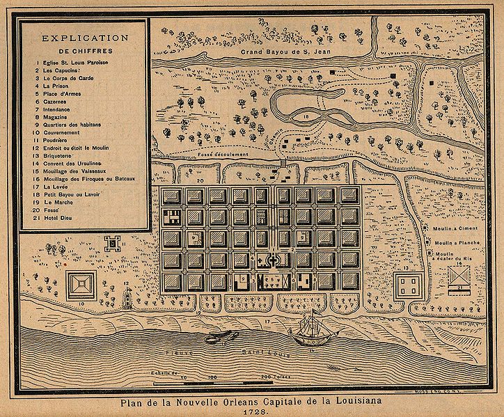
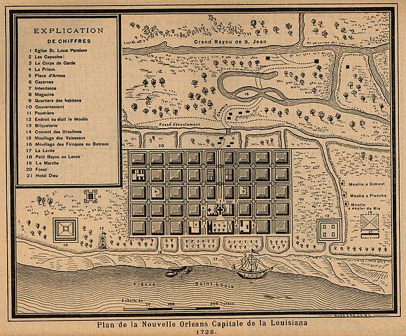
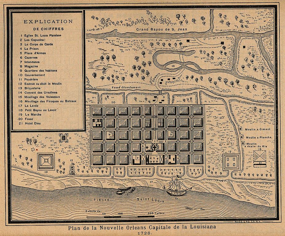
Map of New Orleans, 1728
"Plan de la Nouvelle Orleans Capitale de la Louisiana 1728." From reprint in "Report on the Social Statistics of Cities", Compiled by George E. Waring, Jr., United States. Census Office, Part II, 1886
copyright expired.
Licensing
|
This work is in the public domain in its country of origin and other countries and areas where the copyright term is the author's life plus 70 years or fewer. | |
| This file has been identified as being free of known restrictions under copyright law, including all related and neighboring rights. | |
File history
Click on a date/time to view the file as it appeared at that time.
| Date/Time | Thumbnail | Dimensions | User | Comment | |
|---|---|---|---|---|---|
| current | 06:04, 6 May 2006 | | 1,723 × 1,426 (678 KB) | Infrogmation | Map of New Orleans, 1728 "Plan de la Nouvelle Orleans Capitale de la Louisiana 1728." From Report on the Social Statistics of Cities, Compiled by George E. Waring, Jr., United States. Census Office, Part II, 1886 copyright expired. [[Category:Maps of N |
File usage
The following pages on the English Wikipedia use this file (pages on other projects are not listed):
Global file usage
The following other wikis use this file:
- Usage on es.wikipedia.org
- Usage on fr.wikipedia.org
- Usage on mk.wikipedia.org
- Usage on oc.wikipedia.org
- Usage on ru.wikipedia.org