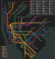
File:New York Subway Map Alargule.svg
Appearance

Size of this PNG preview of this SVG file: 549 × 600 pixels. Other resolutions: 220 × 240 pixels | 439 × 480 pixels | 703 × 768 pixels | 937 × 1,024 pixels | 1,875 × 2,048 pixels | 1,409 × 1,539 pixels.
Original file (SVG file, nominally 1,409 × 1,539 pixels, file size: 1.84 MB)
File history
Click on a date/time to view the file as it appeared at that time.
| Date/Time | Thumbnail | Dimensions | User | Comment | |
|---|---|---|---|---|---|
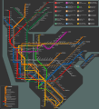
| current | 06:22, 22 December 2016 |  | 1,409 × 1,539 (1.84 MB) | Alargule | Added Q train extension to 96 St |
| 06:55, 7 November 2016 |  | 1,409 × 1,539 (1.84 MB) | Alargule | Added W train. | |
| 18:46, 15 September 2015 |  | 1,409 × 1,516 (1.81 MB) | Alargule | 7 extension included | |
| 09:01, 21 August 2012 |  | 1,409 × 1,516 (4.24 MB) | Alargule | Corrected 138 St error. Smoothed out Harlem river. | |
| 22:02, 20 August 2012 |  | 1,409 × 1,516 (4.24 MB) | Alargule | Darker background, smoother 90 degree curves, different layout of the Woodlawn (4) line in the Bronx, resulting in a lower overall height of the map. | |
| 14:46, 19 March 2011 |  | 1,409 × 1,549 (4.23 MB) | Alargule | Renaming of the new E,G,M,7 transfer complex into "Court Sq". Corrected name of G line's Queens terminus (Court Sq instead of Court St). | |
| 19:51, 13 December 2010 |  | 1,409 × 1,549 (4.24 MB) | Alargule | Some minor error corrections; added more line labels. | |
| 12:12, 12 December 2010 |  | 1,409 × 1,549 (4.22 MB) | Alargule | As it turns out, the MTA had another trick up its sleeve yesterday (Dec 10, 2010): the renaming of the "Broadway/Nassau St" station on the A/C lines to "Fulton St". I've used that to my advantage: now the map displays this station complex as one station, | |
| 19:51, 10 December 2010 |  | 1,409 × 1,549 (3.63 MB) | Alargule | I somehow always liked it better with a dark background. Updated the map with the new transfer complex "Jay St/Metrotech", incorporating the former Jay St (A,C,F) and Lawrence St (R) stations. The Myrtle Ave line between Marcy Ave and Myrtle Ave is now | |
| 15:52, 10 November 2010 |  | 1,409 × 1,549 (4.4 MB) | Alargule | Revised the layout of Downtown Manhattan, to create more space for the station names to fit in. Also removed some unnecessary kinks in the Eighth Avenue and Seventh Avenue lines in Downtown Manhattan. Changed the layout of the Broadway/Lafayette-Bleecker |
File usage
The following page uses this file:
Global file usage
The following other wikis use this file:
- Usage on ja.wikipedia.org
- Usage on nl.wikipedia.org

