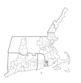
File:New England Town Lines and Borders in 1700.png
Appearance

Size of this preview: 597 × 600 pixels. Other resolutions: 239 × 240 pixels | 478 × 480 pixels | 716 × 719 pixels.
Original file (716 × 719 pixels, file size: 21 KB, MIME type: image/png)
File history
Click on a date/time to view the file as it appeared at that time.
| Date/Time | Thumbnail | Dimensions | User | Comment | |
|---|---|---|---|---|---|
| current | 16:25, 21 September 2022 |  | 716 × 719 (21 KB) | PanzerMan1002 | Minor change for Freetown Border |
| 23:33, 15 June 2018 |  | 716 × 719 (21 KB) | PanzerMan1002 | Thickened Colony/Province borders, county borders in black, town borders in grey to identify counties better | |
| 23:25, 15 June 2018 |  | 717 × 729 (21 KB) | PanzerMan1002 | Thickened Colony/Province borders, county borders in black, town borders in grey to identify counties better | |
| 15:35, 20 October 2017 |  | 717 × 729 (21 KB) | PanzerMan1002 | User created page with UploadWizard |
File usage
The following page uses this file:
Global file usage
The following other wikis use this file:
- Usage on ar.wikipedia.org
