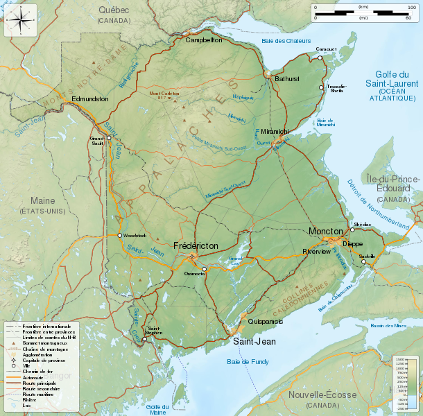
File:New Brunswick topographic map-fr.svg
Appearance

Size of this PNG preview of this SVG file: 610 × 600 pixels. Other resolutions: 244 × 240 pixels | 488 × 480 pixels | 781 × 768 pixels | 1,042 × 1,024 pixels | 2,083 × 2,048 pixels | 2,237 × 2,199 pixels.
Original file (SVG file, nominally 2,237 × 2,199 pixels, file size: 3.31 MB)
File history
Click on a date/time to view the file as it appeared at that time.
| Date/Time | Thumbnail | Dimensions | User | Comment | |
|---|---|---|---|---|---|
| current | 07:06, 23 May 2014 |  | 2,237 × 2,199 (3.31 MB) | Sémhur | Valid SVG |
| 21:18, 29 November 2011 |  | 2,237 × 2,199 (3.31 MB) | Sémhur | == {{int:filedesc}} == {{Information |Description={{Multilingual description |en=General map of New Brunswick, Canada, with topographic bakground (embeded raster file). French version. Equirectangular projection, WGS84 datum *Standa |
File usage
The following page uses this file:
Global file usage
The following other wikis use this file:
- Usage on bn.wikipedia.org
- Usage on fr.wikipedia.org
- Usage on hu.wikipedia.org
- Usage on id.wikipedia.org
- Usage on incubator.wikimedia.org
- Usage on kk.wikipedia.org
- Usage on zea.wikipedia.org
