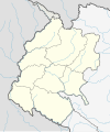
File:Nepal Sudurpashchim Pradesh adm location map.svg
Appearance

Size of this PNG preview of this SVG file: 502 × 599 pixels. Other resolutions: 201 × 240 pixels | 402 × 480 pixels | 643 × 768 pixels | 858 × 1,024 pixels | 1,715 × 2,048 pixels | 531 × 634 pixels.
Original file (SVG file, nominally 531 × 634 pixels, file size: 189 KB)
File history
Click on a date/time to view the file as it appeared at that time.
| Date/Time | Thumbnail | Dimensions | User | Comment | |
|---|---|---|---|---|---|
| current | 18:39, 5 January 2022 |  | 531 × 634 (189 KB) | NordNordWest | c |
| 18:07, 5 January 2022 |  | 531 × 634 (189 KB) | NordNordWest | Kalapani | |
| 06:10, 5 January 2022 |  | 531 × 577 (168 KB) | C1MM | Reverted to version as of 16:57, 22 March 2020 (UTC) Unable to update relief map while keeping overall relief style the same | |
| 06:08, 5 January 2022 |  | 886 × 969 (343 KB) | C1MM | Corrected Kalapani disputed territory and rivers | |
| 16:57, 22 March 2020 |  | 531 × 577 (168 KB) | NordNordWest | corr | |
| 20:15, 13 November 2018 |  | 531 × 577 (165 KB) | NordNordWest | == {{int:filedesc}} == {{Information |description= {{de|1=Positionskarte von Sudurpashchim Pradesh, Nepal}} {{en|1=Location map of Sudurpashchim Pradesh, Nepal}} {{Location map series N |stretching=114 |top=30.3 |bottom=28.3 |left=79.9 |right=82.0 }} |source={{Own using}} * United States National Imagery and Mapping Agency data |date=2018-11-13 |author={{U|NordNordWest}} |permission= |other_versions=<gallery>Nepal Sudurpashchim Pradesh rel location map.svg</gallery> }} {{Kartenwerkstatt}} ==... |
File usage
The following 54 pages use this file:
- Administration in Sudurpashchim Province
- Ajaymeru Rural Municipality
- Apihimal Rural Municipality
- Badikedar Rural Municipality
- Bardagoriya Rural Municipality
- Bedkot
- Beldandi Rural Municipality
- Bhageshwar Rural Municipality
- Bhajani
- Bhimdatta
- Bogatan-Phudsil Rural Municipality
- Bungal Municipality
- Byans, Darchula
- Byans Rural Municipality
- Chure Rural Municipality
- Dasharathchand
- Dhangadhi
- Ganyapadhura Rural Municipality
- Gauriganga
- Ghodaghodi
- Godawari, Kailali
- Jayaprithvi
- Jorayal Rural Municipality
- Joshipur Rural Municipality
- K.I. Singh Rural Municipality
- Kailari Rural Municipality
- Kalapani territory
- Kamalbazar
- Laljhadi Rural Municipality
- Lamkichuha
- Lekam Rural Municipality
- Lipulekh Pass
- List of districts of Nepal
- Mahakali, Darchula
- Malikarjun Rural Municipality
- Mangalsen
- Marma Rural Municipality
- Mohanyal Rural Municipality
- Naugad Rural Municipality
- Panchadewal Binayak
- Parshuram, Dadeldhura
- Punarbas
- Purbichauki Rural Municipality
- Purchaudi
- Sanphebagar
- Sayal Rural Municipality
- Shailyashikhar
- Shikhar, Doti
- Sudurpashchim Province
- Tikapur
- Tinkar
- Template:Sudurpashchim Province districts labelled map
- Module:Location map/data/Nepal Sudurpashchim Province
- Module:Location map/data/Nepal Sudurpashchim Province/doc
Global file usage
The following other wikis use this file:
- Usage on bh.wikipedia.org
- Usage on bn.wikipedia.org
- Usage on de.wikipedia.org
- Usage on eo.wikipedia.org
- Usage on es.wikipedia.org
- Usage on fa.wikipedia.org
- Usage on fr.wikipedia.org
- Usage on he.wikipedia.org
- Usage on hi.wikipedia.org
- Usage on it.wikipedia.org
- Usage on ja.wikipedia.org
- Usage on ne.wikipedia.org
View more global usage of this file.


