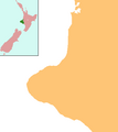
File:NZ-Taranaki plain map.png
Appearance
NZ-Taranaki_plain_map.png (378 × 423 pixels, file size: 10 KB, MIME type: image/png)
File history
Click on a date/time to view the file as it appeared at that time.
| Date/Time | Thumbnail | Dimensions | User | Comment | |
|---|---|---|---|---|---|
| current | 07:04, 2 June 2008 |  | 378 × 423 (10 KB) | Grutness | == Summary == {{Information |Description=Locator map for Taranaki, New Zealand |Source=combination of Image:NZ-NI plain map.png and Image:Position of Taranaki.png |Date=3 June 2008 |Author=Grutness |Permission=public domain |other_versions= }} [ |
File usage
The following 39 pages use this file:
- Ahititi
- Alton, New Zealand
- Cardiff, New Zealand
- Huiakama
- Huirangi
- Huiroa
- Hurleyville
- Hurworth, New Zealand
- Kaimata
- Kakaramea
- Lake Dive
- Lake Rotokare
- List of schools in Taranaki
- Manutahi
- Marco, New Zealand
- Matapu
- Mimi, New Zealand
- Mokoia
- Motunui
- New Plymouth
- New Plymouth Airport
- Ngaere
- Oaonui
- Parihaka
- Pungarehu
- Purangi
- Second Taranaki War
- Strathmore, New Zealand
- Tahora, Manawatū-Whanganui
- Tariki, New Zealand
- Te Popo
- Tongapōrutu
- Tututawa
- Tītokowaru's War
- Warea, New Zealand
- Whenuakura
- Module:Location map/data/New Zealand Taranaki
- Module:Location map/data/New Zealand Taranaki/doc
- Module:Location map/data/Taranaki
Global file usage
The following other wikis use this file:
- Usage on ar.wikipedia.org
- Usage on ceb.wikipedia.org
- Usage on fa.wikipedia.org
- Usage on fr.wikipedia.org
- Usage on kn.wikipedia.org
- Usage on ko.wikipedia.org
- Usage on mi.wikipedia.org
- Usage on pl.wikivoyage.org
- Usage on sco.wikipedia.org
- Usage on simple.wikipedia.org
- Usage on si.wikipedia.org
- Usage on tr.wikipedia.org
- Usage on ur.wikipedia.org
- Usage on uz.wikipedia.org
View more global usage of this file.

