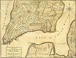
File:NYC1776 labelled.jpg
Appearance

Size of this preview: 778 × 600 pixels. Other resolutions: 312 × 240 pixels | 623 × 480 pixels | 997 × 768 pixels | 1,280 × 986 pixels | 2,560 × 1,973 pixels | 4,360 × 3,360 pixels.
Original file (4,360 × 3,360 pixels, file size: 7.88 MB, MIME type: image/jpeg)
File history
Click on a date/time to view the file as it appeared at that time.
| Date/Time | Thumbnail | Dimensions | User | Comment | |
|---|---|---|---|---|---|
| current | 00:55, 7 March 2017 |  | 4,360 × 3,360 (7.88 MB) | Beyond My Ken | == {{int:filedesc}} == {{Information |Description={{en|A 1776 map of New York City. Map has had border cropped and color adjusted from original. This version had Corlears Hook labelled and New Delancey Square marked.}} |Source=The B... |
File usage
The following page uses this file:
Global file usage
The following other wikis use this file:
- Usage on es.wikipedia.org
- Usage on ru.wikipedia.org


