
File:NWS Key West office barometer as Hurricane Irma approached.jpg

Size of this preview: 800 × 600 pixels. Other resolutions: 320 × 240 pixels | 640 × 480 pixels | 1,024 × 768 pixels | 1,200 × 900 pixels.
Original file (1,200 × 900 pixels, file size: 171 KB, MIME type: image/jpeg)
| This is a file from the Wikimedia Commons. Information from its description page there is shown below. Commons is a freely licensed media file repository. You can help. |
Summary
| Description |
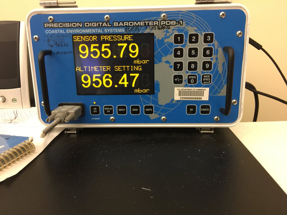
English: A digital barometer in the National Weather Service's local forecast office in Key West, Florida as Hurricane Irma approached the lower Keys on the morning of Sunday, September 10, 2017. Photo tweeted by the office's official account with the following text: "8AM: Pressure continues to drop as the eye of #Irma moves into the Lower Keys." |
| Date | |
| Source | Tweeted by NWS Key West office (Image URL) |
| Author | National Weather Service Key West office |
| Camera location | | View this and other nearby images on: OpenStreetMap |
|---|
Licensing
| This file is in the public domain in the United States because it was solely created by the National Weather Service (including its name from 1870–1970, the United States Weather Bureau).
As a file created by an employee of the NWS (formerly USWB) in the course of their official duties, whether hosted
this work is in the public domain in the United States because it is a work prepared by an officer or employee of the United States Government as part of that person’s official duties under the terms of Title 17, Chapter 1, Section 105 of the US Code. |
||
 |
Warnings:
|
File history
Click on a date/time to view the file as it appeared at that time.
| Date/Time | Thumbnail | Dimensions | User | Comment | |
|---|---|---|---|---|---|
| current | 12:32, 19 September 2017 | | 1,200 × 900 (171 KB) | AHeneen | User created page with UploadWizard |
File usage
The following pages on the English Wikipedia use this file (pages on other projects are not listed):
Global file usage
The following other wikis use this file:
- Usage on ca.wikipedia.org