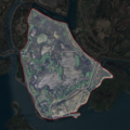
File:NASA Worldwind, USGS imagery map, Dutton Island, California.png
Appearance

Size of this preview: 600 × 600 pixels. Other resolutions: 240 × 240 pixels | 480 × 480 pixels | 900 × 900 pixels.
Original file (900 × 900 pixels, file size: 1.14 MB, MIME type: image/png)
File history
Click on a date/time to view the file as it appeared at that time.
| Date/Time | Thumbnail | Dimensions | User | Comment | |
|---|---|---|---|---|---|
| current | 02:11, 23 February 2021 |  | 900 × 900 (1.14 MB) | JPxG | absolutely cannot stop messing with this |
| 02:09, 23 February 2021 |  | 900 × 900 (1.14 MB) | JPxG | might as well just make an actually good one instead at this point | |
| 01:50, 23 February 2021 |  | 200 × 250 (79 KB) | JPxG | Make border more clear | |
| 01:47, 23 February 2021 |  | 200 × 250 (78 KB) | JPxG | Define boundary and crop to fit, per reclamation district and USGS survey maps | |
| 06:40, 17 September 2020 |  | 537 × 462 (380 KB) | JPxG | {{Information |description ={{en|1=Aerial photo of an island.}} |date =2020-09-16 |source =NASA tool at worldwind.earth, USGS Topo Imagery map layer |author =USGS imagery |permission ={{PD-USGov-USGS}} }} Category:Islands of California |
File usage
The following 2 pages use this file:
Global file usage
The following other wikis use this file:
- Usage on ceb.wikipedia.org
- Usage on www.wikidata.org

