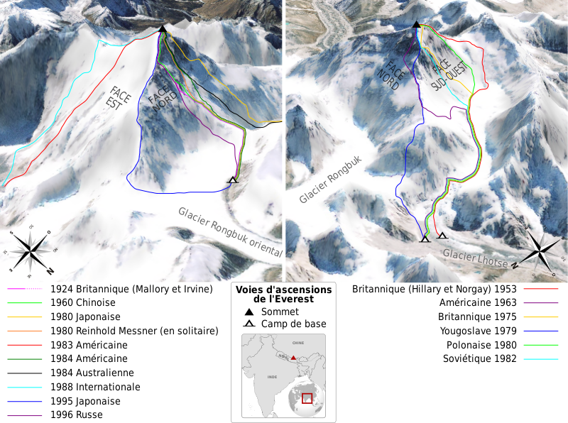
File:Mount Everest Climbing Routes 1924-1996 photomap-fr.svg
Appearance

Size of this PNG preview of this SVG file: 800 × 596 pixels. Other resolutions: 320 × 238 pixels | 640 × 477 pixels | 1,024 × 763 pixels | 1,280 × 954 pixels | 2,560 × 1,907 pixels | 1,208 × 900 pixels.
Original file (SVG file, nominally 1,208 × 900 pixels, file size: 1.11 MB)
File history
Click on a date/time to view the file as it appeared at that time.
| Date/Time | Thumbnail | Dimensions | User | Comment | |
|---|---|---|---|---|---|
| current | 11:45, 16 June 2009 |  | 1,208 × 900 (1.11 MB) | Sémhur | =={{int:summary}}== {{Information |Description= {{en|Map of the climbing routes opened on mount Everest by different expeditions between 1924 and 1996. Left view shows mount Everest at 215°, right view at 110°. French version.}} {{ |
File usage
The following page uses this file:
Global file usage
The following other wikis use this file:
- Usage on bs.wikipedia.org
- Usage on fr.wikipedia.org
- Usage on sh.wikipedia.org
- Usage on sr.wikipedia.org
- Usage on zh.wikipedia.org
