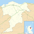
File:Moray UK location map.svg
Appearance

Size of this PNG preview of this SVG file: 595 × 599 pixels. Other resolutions: 238 × 240 pixels | 477 × 480 pixels | 763 × 768 pixels | 1,017 × 1,024 pixels | 2,034 × 2,048 pixels | 1,414 × 1,424 pixels.
Original file (SVG file, nominally 1,414 × 1,424 pixels, file size: 1.22 MB)
File history
Click on a date/time to view the file as it appeared at that time.
| Date/Time | Thumbnail | Dimensions | User | Comment | |
|---|---|---|---|---|---|
| current | 20:18, 26 September 2010 |  | 1,414 × 1,424 (1.22 MB) | Nilfanion | {{Information |Description=Blank map of Moray, UK with the following information shown: *Administrative borders *Coastline, lakes and rivers *Roads and railways *Urban areas Equirectangular map projection on WGS 84 datum, with N/S stretched 1 |
File usage
The following 99 pages use this file:
- Aberlour
- Aikenway Castle
- Alves, Moray
- Arradoul
- Auchbreck
- Auchnarrow
- Aultmore
- Ballindalloch Castle
- Battle of Pitgaveny
- Benromach distillery
- Bilbohall Hospital
- Borough Briggs
- Brodie Castle
- Buckie
- Burghead
- Burghead Transmitting Station
- Burniestrype
- Cabrach
- Cooper Park drill hall, Elgin
- Craigellachie, Moray
- Cullen, Moray
- Cullen House
- Cullen Town Hall
- Cummingston
- Dallas, Moray
- Deskford
- Dipple, Moray
- Dr Gray's Hospital
- Drummuir
- Dufftown
- Dunphail Castle
- Dyke, Moray
- Earnside Castle
- Elgin, Moray
- Elgin Sheriff Court
- Elgin Town Hall
- Findhorn
- Findochty
- Fleming Cottage Hospital
- Fochabers
- Forres
- Forres Tolbooth
- Forres Town Hall
- Garmouth
- Gauldwell Castle
- Glen Moray distillery
- Glenfiddich distillery
- Grange, Moray
- Grant Hall, Rothes
- Hempriggs Castle
- Hopeman
- Inverugie Castle, Moray
- Keith, Moray
- Kellas, Moray
- Kinloss, Scotland
- Kinloss Barracks
- Knock More transmitting station
- Leanchoil Hospital
- Lhanbryde
- List of monastic houses in Scotland
- Longmorn
- Lossiemouth
- Lossiemouth Town Hall
- Maggieknockater
- Milltown of Rothiemay
- Miltonduff
- Moray
- Morayvia
- Mosset Park
- Mosstodloch
- Mulben
- Newmill
- Portknockie
- RAF Dallachy
- RAF Elgin
- RAF Forres
- RAF Kinloss
- RAF Lossiemouth
- RAF Milltown
- Rafford
- Rathven
- Rothes
- Seafield Hospital
- Spey Bay
- Spynie Hospital
- St Peter's Roman Catholic Church, Buckie
- St Rufus Church
- Stephen Cottage Hospital
- The Glenlivet distillery
- The Macallan distillery
- The Oaks, Elgin
- Tomintoul
- Turner Memorial Hospital
- Union Street drill hall, Keith, Moray
- Upper Dallachy
- Urquhart, Moray
- User:George Burgess/sandbox
- Module:Location map/data/Scotland Moray
- Module:Location map/data/Scotland Moray/doc
Global file usage
The following other wikis use this file:
- Usage on ar.wikipedia.org
- Usage on azb.wikipedia.org
- Usage on bg.wikipedia.org
- Usage on ceb.wikipedia.org
- Usage on cy.wikipedia.org
- Usage on de.wikipedia.org
- Usage on eo.wikipedia.org
- Usage on es.wikipedia.org
- Wikiproyecto:Ilustración/Taller de Cartografía/Realizaciones/Europa
- Plantilla:Mapa de localización de Moray
- Dufftown
- Hopeman
- Findochty
- Findhorn
- Cullen (Escocia)
- Burghead
- Buckie
- Garmouth
- Lossiemouth
- Forres (Escocia)
- Fochabers
- Charlestown of Aberlour
- Lhanbryde
- Kinloss
- Rothes
- Keith (Escocia)
- Portknockie
- Portgordon
- Mosstodloch
- Usage on fa.wikipedia.org
- Usage on fr.wikipedia.org
View more global usage of this file.
