
File:Middle east map.png
No higher resolution available.
Middle_east_map.png (289 × 180 pixels, file size: 7 KB, MIME type: image/png)
| This is a file from the Wikimedia Commons. Information from its description page there is shown below. Commons is a freely licensed media file repository. You can help. |

|
This locator map image could be re-created using vector graphics as an SVG file. This has several advantages; see Commons:Media for cleanup for more information. If an SVG form of this image is available, please upload it and afterwards replace this template with
{{vector version available|new image name}}.
It is recommended to name the SVG file “Middle east map.svg”—then the template Vector version available (or Vva) does not need the new image name parameter. |
Summary
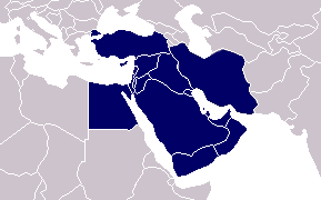
Map of the Middle East based on the blank world map by Vardion. Depicts the Middle East as described by the corresponding Wikipedia article. Note that the Middle East is not clearly delimited, so other configurations of the region are possible. See Middle_Eastern_Regions for more information.
Licensing
| This work has been released into the public domain by its author, Vardion. This applies worldwide. In some countries this may not be legally possible; if so: |
File history
Click on a date/time to view the file as it appeared at that time.
| Date/Time | Thumbnail | Dimensions | User | Comment | |
|---|---|---|---|---|---|
| current | 22:38, 14 May 2012 | | 289 × 180 (7 KB) | Maphobbyist | Turkey is also included in the Middle East. |
| 18:27, 5 September 2010 |  | 289 × 180 (8 KB) | پسر آمل | Iran is a big country in Middle east | |
| 15:02, 19 November 2006 |  | 289 × 180 (6 KB) | Zaparojdik~commonswiki | ||
| 13:37, 10 February 2005 |  | 289 × 180 (4 KB) | Lfkrebs | Middle East Map |
File usage
The following 2 pages use this file:
Global file usage
The following other wikis use this file:
- Usage on ca.wikipedia.org
- Usage on cy.wikipedia.org
- Usage on da.wikipedia.org
- Usage on en.wikiquote.org
- Usage on fa.wikipedia.org
- Usage on incubator.wikimedia.org
- Usage on ka.wikipedia.org
- Usage on nl.wikipedia.org
- Usage on pt.wikiquote.org
- Usage on pt.wikivoyage.org
- Usage on sv.wikinews.org
- Usage on www.wikidata.org