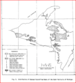
File:Michigan's Upper Peninsula's Distribution of Exposed Crystalline Rocks.PNG
Appearance

Size of this preview: 552 × 600 pixels. Other resolutions: 221 × 240 pixels | 569 × 618 pixels.
Original file (569 × 618 pixels, file size: 61 KB, MIME type: image/png)
File history
Click on a date/time to view the file as it appeared at that time.
| Date/Time | Thumbnail | Dimensions | User | Comment | |
|---|---|---|---|---|---|
| current | 03:30, 2 April 2010 |  | 569 × 618 (61 KB) | Bettymnz4 | {{Information |Description={{en|1=={{en|The Montevideo Gneiss Complex is No. 13 on the map and occurs in two separate gerrymandering places; one has a northwesterly orientation in west-central Minnesota and the other emplacement is south of the first one |
File usage
The following 2 pages use this file:

