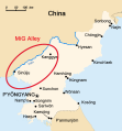
File:MiG Alley Map (en).svg
Appearance

Size of this PNG preview of this SVG file: 557 × 599 pixels. Other resolutions: 223 × 240 pixels | 446 × 480 pixels | 714 × 768 pixels | 952 × 1,024 pixels | 1,903 × 2,048 pixels | 696 × 749 pixels.
Original file (SVG file, nominally 696 × 749 pixels, file size: 135 KB)
File history
Click on a date/time to view the file as it appeared at that time.
| Date/Time | Thumbnail | Dimensions | User | Comment | |
|---|---|---|---|---|---|
| current | 17:14, 14 June 2017 |  | 696 × 749 (135 KB) | Howard61313 | new |
| 17:05, 14 June 2017 |  | 696 × 749 (135 KB) | Howard61313 | new | |
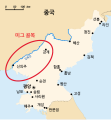
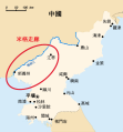
| 15:11, 14 June 2017 |  | 696 × 749 (135 KB) | Howard61313 | {{Information |Description={{en| The area called "MiG Alley" during the Korean War (1950-53) on the Chinese-North Korean border.}} |Source={{Derived from|MiG Alley Map.JPG}} |Date=2017-06-14 |Author= * Triggerhappy ({{i18n/origina... |
File usage
The following 2 pages use this file:
Global file usage
The following other wikis use this file:
- Usage on cs.wikipedia.org
- Usage on de.wikipedia.org
- Usage on es.wikipedia.org
- Usage on es.wikibooks.org
- Usage on eu.wikipedia.org
- Usage on fr.wikipedia.org
- Usage on pt.wikipedia.org
- Usage on sk.wikipedia.org
- Usage on vi.wikipedia.org


