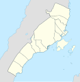
File:Metro Cebu location map.svg
Appearance

Size of this PNG preview of this SVG file: 586 × 599 pixels. Other resolutions: 235 × 240 pixels | 469 × 480 pixels | 751 × 768 pixels | 1,001 × 1,024 pixels | 2,003 × 2,048 pixels | 798 × 816 pixels.
Original file (SVG file, nominally 798 × 816 pixels, file size: 126 KB)
File history
Click on a date/time to view the file as it appeared at that time.
| Date/Time | Thumbnail | Dimensions | User | Comment | |
|---|---|---|---|---|---|
| current | 12:37, 1 October 2021 |  | 798 × 816 (126 KB) | Hariboneagle927 | Uploaded own work with UploadWizard |
File usage
The following 19 pages use this file:
- Archdiocesan Shrine of Santa Teresa de Avila
- Basilica del Santo Niño
- Cebu Business Park
- Cebu Metropolitan Cathedral
- Cebu North Bus Terminal
- Cebu Taoist Temple
- Compañía Marítima Building
- Cordova Desalination Plant
- Guadalupe Mabugnao Mainit Hot Spring National Park
- Mactan Shrine
- Mactan–Benito Ebuen Air Base
- Mactan–Cebu International Airport
- Mandaue Church
- Nustar Resort and Casino
- Silot Lagoon
- South Road Properties
- St. Catherine's Church, Carcar
- Module:Location map/data/Metro Cebu
- Module:Location map/data/Metro Cebu/doc
Global file usage
The following other wikis use this file:
- Usage on bcl.wikipedia.org
- Usage on fr.wikipedia.org
- Usage on ms.wikipedia.org
- Usage on si.wikipedia.org
- Usage on zh.wikipedia.org

