File:Maxwell Air Force Base.jpg
Appearance

Size of this preview: 600 × 600 pixels. Other resolutions: 240 × 240 pixels | 480 × 480 pixels | 768 × 768 pixels | 1,024 × 1,024 pixels | 2,048 × 2,048 pixels | 4,039 × 4,039 pixels.
Original file (4,039 × 4,039 pixels, file size: 4.76 MB, MIME type: image/jpeg)
File history
Click on a date/time to view the file as it appeared at that time.
| Date/Time | Thumbnail | Dimensions | User | Comment | |
|---|---|---|---|---|---|
| current | 00:55, 9 March 2012 |  | 4,039 × 4,039 (4.76 MB) | Hohum | Levels |
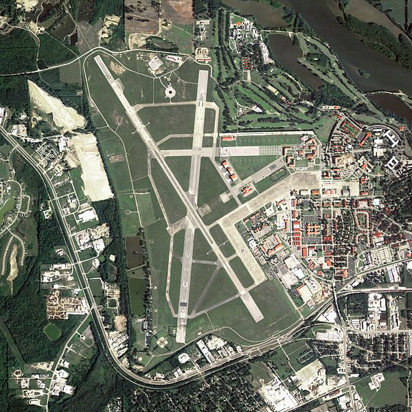
| 21:11, 21 June 2009 |  | 4,039 × 4,039 (4.95 MB) | AuburnPilot | == Summary == {{Information |Description=Satellite image of Maxwell Air Force Base in Montgomery, Alabama, United States on 15 June 2006 |Source=United States Geological Survey (National Agriculture Imagery Program (NAIP) Ort |
File usage
The following page uses this file:
Global file usage
The following other wikis use this file:
- Usage on fr.wikipedia.org
- Usage on sv.wikipedia.org
- Usage on uk.wikipedia.org
- Usage on zh.wikipedia.org

