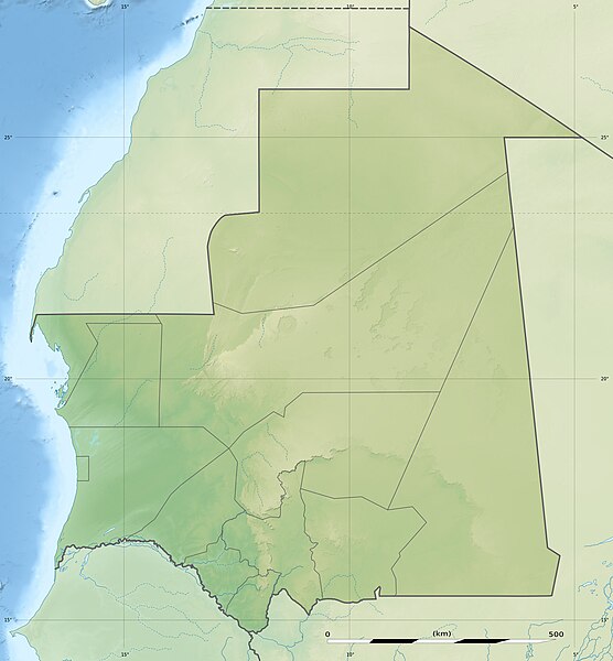
File:Mauritania relief location map.jpg
Appearance

Size of this preview: 556 × 600 pixels. Other resolutions: 222 × 240 pixels | 445 × 480 pixels | 712 × 768 pixels | 949 × 1,024 pixels | 1,283 × 1,384 pixels.
Original file (1,283 × 1,384 pixels, file size: 257 KB, MIME type: image/jpeg)
File history
Click on a date/time to view the file as it appeared at that time.
| Date/Time | Thumbnail | Dimensions | User | Comment | |
|---|---|---|---|---|---|
| current | 13:14, 19 July 2010 |  | 1,283 × 1,384 (257 KB) | Sting | Color profile |
| 13:47, 23 November 2009 |  | 1,283 × 1,384 (256 KB) | Sting | == {{int:filedesc}} == {{Location|21|00|00|N|10|57|00|W|scale:7000000}} <br/> {{Information |Description={{en|Blank physical map of Mauritania, for geo-location purposes.}} {{fr|Carte physique vierge de la Mauritanie, |
File usage
The following 37 pages use this file:
- 2005 El Mreiti base attack
- 2008 Nouakchott Israeli embassy attack
- Agrour Amogjar
- Amazmaz
- Amojjar Pass
- Ancient Ksour of Ouadane, Chinguetti, Tichitt and Oualata
- Atar, Mauritania
- Azougui
- Battle of Tabfarilla
- Bay of Arguin
- Chinguetti Mosque
- Dafor
- Dakhlet Nouadhibou
- Dhar Tichitt
- Diadjibine Gandéga
- Diawling National Park
- Foum Gleita Dam
- Friday Mosque of Nouakchott
- Gogui, Mauritania
- Gorgol River
- Ibn Abass Mosque
- Kediet ej Jill
- Kouroudjel
- Lac de Mâl
- Lake Gabou
- Lake R'Kiz
- List of fossiliferous stratigraphic units in Mauritania
- Marocaine Mosque
- Nouadhibou Mosque
- Nouakchott
- Paul Soleillet
- Richat Structure
- Saudi Mosque
- Ten Hamadi
- Tifoujar Pass
- Module:Location map/data/Mauritania
- Module:Location map/data/Mauritania/doc
Global file usage
The following other wikis use this file:
- Usage on af.wikipedia.org
- Usage on ar.wikipedia.org
- Usage on ast.wikipedia.org
- Usage on az.wikipedia.org
- Usage on ba.wikipedia.org
- Usage on be.wikipedia.org
- Usage on bg.wikipedia.org
- Usage on bn.wikipedia.org
- Usage on bs.wikipedia.org
- Usage on ceb.wikipedia.org
- Usage on ce.wikipedia.org
- Usage on ckb.wikipedia.org
- Usage on cs.wikipedia.org
- Usage on da.wikipedia.org
- Usage on de.wikipedia.org
- Arguin
- Mauretanien
- Ras Nouadhibou
- Vorlage:Positionskarte Mauretanien
- Aouelloul
- Wikipedia:Kartenwerkstatt/Positionskarten/Afrika
- Tenoumer
- Arguin-Sandbank
- Kijji
- Tidra
- Kediet Ijill
- Kiaone-Inseln
- Welterbe in Mauretanien
- Antike Ksur von Ouadane, Chinguetti, Tichitt und Oualata
- Liste von Kraftwerken in Mauretanien
- Nair (Arguin-Sandbank)
- Usage on de.wikivoyage.org
View more global usage of this file.


