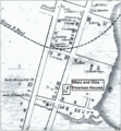
File:Mary and Eliza Freeman Houses map 1850.png
Appearance

Size of this preview: 553 × 599 pixels. Other resolutions: 221 × 240 pixels | 443 × 480 pixels | 708 × 768 pixels | 1,167 × 1,265 pixels.
Original file (1,167 × 1,265 pixels, file size: 917 KB, MIME type: image/png)
File history
Click on a date/time to view the file as it appeared at that time.
| Date/Time | Thumbnail | Dimensions | User | Comment | |
|---|---|---|---|---|---|
| current | 18:51, 4 August 2010 |  | 1,167 × 1,265 (917 KB) | AbbyKelleyite | Larger Text |
| 18:41, 4 August 2010 |  | 1,167 × 1,265 (920 KB) | AbbyKelleyite | {{Information |Description=Map of South End neighborhood of Bridgeport, Connecticut depicting churches of Little Liberia, an African American neighborhood with designations of historic homes. |Source=*[[:File:Little_Liberia_(Bridgeport,_Connecticut)_1850. |
File usage
The following page uses this file:
Global file usage
The following other wikis use this file:
- Usage on www.wikidata.org


