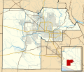
File:Maricopa County Arizona Incorporated and Unincorporated areas.svg
Appearance

Size of this PNG preview of this SVG file: 694 × 599 pixels. Other resolutions: 278 × 240 pixels | 556 × 480 pixels | 889 × 768 pixels | 1,185 × 1,024 pixels | 2,371 × 2,048 pixels | 940 × 812 pixels.
Original file (SVG file, nominally 940 × 812 pixels, file size: 1.05 MB)
File history
Click on a date/time to view the file as it appeared at that time.
| Date/Time | Thumbnail | Dimensions | User | Comment | |
|---|---|---|---|---|---|
| current | 07:35, 18 May 2011 |  | 940 × 812 (1.05 MB) | Ixnayonthetimmay | == {{int:filedesc}} == {{Information |Description=This map shows the incorporated areas and Indian reservation boundaries in Maricopa County, Arizona, along w |
| 03:28, 30 August 2008 |  | 900 × 800 (410 KB) | Ixnayonthetimmay | {{Information |Description={{en|1=== Summary == {{Information |Description=This map shows the incorporated areas and unincorporated areas in Pinal County, [[:en:Arizona|Ariz |
File usage
The following 3 pages use this file:
Global file usage
The following other wikis use this file:
- Usage on de.wikipedia.org
