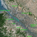
File:Marennes-Oleron.svg
Appearance

Size of this PNG preview of this SVG file: 500 × 500 pixels. Other resolutions: 240 × 240 pixels | 480 × 480 pixels | 768 × 768 pixels | 1,024 × 1,024 pixels | 2,048 × 2,048 pixels.
Original file (SVG file, nominally 500 × 500 pixels, file size: 170 KB)
File history
Click on a date/time to view the file as it appeared at that time.
| Date/Time | Thumbnail | Dimensions | User | Comment | |
|---|---|---|---|---|---|
| current | 15:41, 4 October 2014 |  | 500 × 500 (170 KB) | Droop | lisibilité |
| 15:05, 11 June 2009 |  | 500 × 500 (169 KB) | Emmanuel.boutet | recentré | |
| 09:37, 11 June 2009 |  | 744 × 1,052 (168 KB) | Droop | {{Information |Description={{fr|1=Géolocalisation satellite des principales communes bordant l'estuaire de la Seudre (Charente-Maritime).}} |Source=travail personnel (own work) and http://gallery.spotimage.com/product_info.php?products_id=1297 |Author=[[ |
File usage
The following page uses this file:
Global file usage
The following other wikis use this file:
- Usage on de.wikipedia.org
- Usage on eo.wikipedia.org
- Usage on fr.wikipedia.org
- Usage on sv.wikipedia.org

