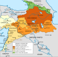
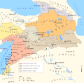
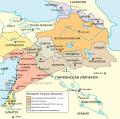
File:Maps of the Armenian Empire of Tigranes-es.svg
Appearance

Size of this PNG preview of this SVG file: 605 × 600 pixels. Other resolutions: 242 × 240 pixels | 484 × 480 pixels | 775 × 768 pixels | 1,033 × 1,024 pixels | 2,066 × 2,048 pixels | 1,975 × 1,958 pixels.
Original file (SVG file, nominally 1,975 × 1,958 pixels, file size: 640 KB)
File history
Click on a date/time to view the file as it appeared at that time.
| Date/Time | Thumbnail | Dimensions | User | Comment | |
|---|---|---|---|---|---|
| current | 11:25, 26 August 2023 |  | 1,975 × 1,958 (640 KB) | Milenioscuro | recorte del borde |
| 22:31, 9 December 2018 |  | 1,996 × 2,000 (613 KB) | Rowanwindwhistler | Improved version | |
| 07:39, 4 April 2016 |  | 512 × 506 (55 KB) | Rowanwindwhistler | New colours from http://colorbrewer2.org/ | |
| 08:41, 1 March 2016 |  | 512 × 506 (54 KB) | Rowanwindwhistler | Sea & coast colours from https://en.wikipedia.org/wiki/Wikipedia:WikiProject_Maps/Conventions Some text corrected and moved | |
| 17:54, 9 July 2015 |  | 512 × 506 (48 KB) | Rowanwindwhistler | User created page with UploadWizard |
File usage
The following 2 pages use this file:
Global file usage
The following other wikis use this file:
- Usage on arz.wikipedia.org
- Usage on ast.wikipedia.org
- Usage on el.wikipedia.org
- Usage on es.wikipedia.org
- Usage on hy.wikipedia.org
- Usage on hyw.wikipedia.org
- Usage on ia.wikipedia.org
- Usage on www.wikidata.org


