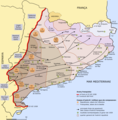
File:Mapa guerra civil.png
Appearance

Size of this preview: 590 × 600 pixels. Other resolutions: 236 × 240 pixels | 472 × 480 pixels | 737 × 749 pixels.
Original file (737 × 749 pixels, file size: 246 KB, MIME type: image/png)
File history
Click on a date/time to view the file as it appeared at that time.
| Date/Time | Thumbnail | Dimensions | User | Comment | |
|---|---|---|---|---|---|
| current | 14:15, 27 January 2019 |  | 737 × 749 (246 KB) | Auledas | Reverted to version as of 14:13, 27 January 2019 (UTC) |
| 14:14, 27 January 2019 |  | 737 × 749 (234 KB) | Auledas | Reverted to version as of 15:03, 10 October 2016 (UTC) | |
| 14:13, 27 January 2019 |  | 737 × 749 (246 KB) | Auledas | Canvi. | |
| 14:01, 27 January 2019 |  | 737 × 749 (246 KB) | Auledas | Correcció 'Pamós' -> 'Palamós' i recol·locació 'Espanya' per intentar que no quedi sobre la Franja. | |
| 15:03, 10 October 2016 |  | 737 × 749 (234 KB) | EBatlleP | millora de les referències pel posicionament geogràfic | |
| 14:33, 10 October 2016 |  | 744 × 751 (227 KB) | EBatlleP | User created page with UploadWizard |
File usage
The following 2 pages use this file:
Global file usage
The following other wikis use this file:
- Usage on ca.wikipedia.org
- Usage on ca.wikibooks.org
- Usage on de.wikipedia.org
- Usage on www.wikidata.org
