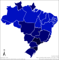
File:Mapa dos estados brasileiros por IDH (2010).svg
Appearance

Size of this PNG preview of this SVG file: 613 × 600 pixels. Other resolutions: 245 × 240 pixels | 491 × 480 pixels | 785 × 768 pixels | 1,047 × 1,024 pixels | 2,094 × 2,048 pixels | 775 × 758 pixels.
Original file (SVG file, nominally 775 × 758 pixels, file size: 205 KB)
File history
Click on a date/time to view the file as it appeared at that time.
| Date/Time | Thumbnail | Dimensions | User | Comment | |
|---|---|---|---|---|---|
| current | 18:38, 13 August 2023 |  | 775 × 758 (205 KB) | Allice Hunter | Numeração |
| 21:48, 27 June 2021 |  | 512 × 521 (200 KB) | Allice Hunter | New colour scheme and quality adjustments | |
| 23:42, 8 May 2019 |  | 512 × 521 (210 KB) | Allice Hunter | Final Version | |
| 23:40, 8 May 2019 |  | 512 × 521 (210 KB) | Allice Hunter | Adjustment, and probably the final version | |
| 01:50, 6 March 2019 |  | 512 × 521 (208 KB) | Allice Hunter | Standardization with other maps | |
| 22:59, 22 December 2018 |  | 774 × 891 (328 KB) | Allice Hunter | Final Version | |
| 16:47, 6 December 2018 |  | 768 × 782 (296 KB) | Allice Hunter | . | |
| 00:29, 5 December 2018 |  | 766 × 760 (215 KB) | Allice Hunter | User created page with UploadWizard |
File usage
The following page uses this file:
Global file usage
The following other wikis use this file:
- Usage on pt.wikipedia.org
- Usage on th.wikipedia.org
