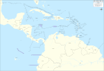
File:Mapa del Caribe (límites marinos).png
Appearance

Size of this preview: 800 × 530 pixels. Other resolutions: 320 × 212 pixels | 640 × 424 pixels | 1,024 × 679 pixels | 1,280 × 849 pixels | 2,514 × 1,667 pixels.
Original file (2,514 × 1,667 pixels, file size: 202 KB, MIME type: image/png)
File history
Click on a date/time to view the file as it appeared at that time.
| Date/Time | Thumbnail | Dimensions | User | Comment | |
|---|---|---|---|---|---|
| current | 20:16, 25 December 2008 |  | 2,514 × 1,667 (202 KB) | Milenioscuro | {{Information |Description={{en|1=Map of maritime boundaries in the Caribbean Sea and Gulf of Mexico}} {{es|1=Mapa de los límites marinos en el Mar Caribe y el Golfo de México}} |Source=Own work |Author=Shadowxfox |Date=2008 |Permiss |
File usage
The following page uses this file:


