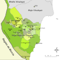
File:Mapa de la Vega Baja del Segura.svg
Appearance

Size of this PNG preview of this SVG file: 595 × 595 pixels. Other resolutions: 240 × 240 pixels | 480 × 480 pixels | 768 × 768 pixels | 1,024 × 1,024 pixels | 2,048 × 2,048 pixels.
Original file (SVG file, nominally 595 × 595 pixels, file size: 504 KB)
File history
Click on a date/time to view the file as it appeared at that time.
| Date/Time | Thumbnail | Dimensions | User | Comment | |
|---|---|---|---|---|---|
| current | 20:07, 1 December 2022 |  | 595 × 595 (504 KB) | Vanished user 4afd12r8rh7r5t6r45tr41k8r54dtr56l0e | Reverted to version as of 21:23, 4 October 2017 (UTC) The new version makes no sense in the naming, which is not official (País Valenciano, Múrcia) |
| 09:59, 23 August 2022 |  | 595 × 595 (477 KB) | Martorell | Fixing administrative borders between Land of Valencia and Region of Murcia. | |
| 21:23, 4 October 2017 |  | 595 × 595 (504 KB) | PuriGarcía | Reverted to version as of 17:01, 21 March 2008 (UTC) | |
| 21:20, 4 October 2017 |  | 1,280 × 1,280 (19 KB) | PuriGarcía | Nuevos | |
| 17:01, 21 March 2008 |  | 595 × 595 (504 KB) | Rodriguillo | {{Information |Description= |Source=self-made |Date= |Author= Rodriguillo |Permission= |other_versions= }} | |
| 17:21, 22 February 2008 |  | 595 × 595 (512 KB) | Rodriguillo | {{Information |Description= Mapa de la comarca de la '''Marina Alta''' (provincia de Alicante, España) |Source=Image:Mapa de la Marina Alta.png, Image:Alicante - Mapa municipal.svg |Date=Original: december 2004. Vectorization: february 2008 |A |
File usage
The following page uses this file:
Global file usage
The following other wikis use this file:
- Usage on es.wikipedia.org


