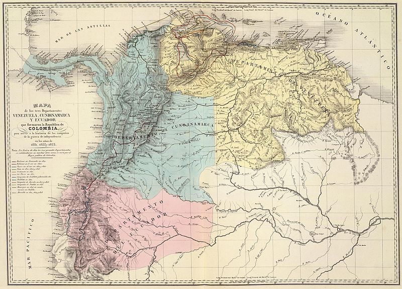
File:Mapa de Venezuela, N. Granada y Quito, 1821.jpg
Appearance

Size of this preview: 800 × 575 pixels. Other resolutions: 320 × 230 pixels | 640 × 460 pixels | 1,024 × 736 pixels | 1,280 × 920 pixels | 2,417 × 1,737 pixels.
Original file (2,417 × 1,737 pixels, file size: 1.43 MB, MIME type: image/jpeg)
File history
Click on a date/time to view the file as it appeared at that time.
| Date/Time | Thumbnail | Dimensions | User | Comment | |
|---|---|---|---|---|---|
| current | 06:01, 6 June 2008 |  | 2,417 × 1,737 (1.43 MB) | Milenioscuro | {{Information |Description= |Source= |Date= |Author= |Permission= |other_versions= }} |
| 12:24, 3 January 2008 |  | 1,247 × 903 (368 KB) | Milenioscuro | {{Information |Description=Gran Colombia dividida en 3 departamentos en 1821 |Source=http://www.davidrumsey.com |Date=1840 |Author=Agustín Codazzi |Permission= |other_versions= }} Category:Gran Colombia Category:Old maps of Colombia [[Category:Ol |
File usage
The following 2 pages use this file:
Global file usage
The following other wikis use this file:
- Usage on ar.wikipedia.org
- Usage on es.wikipedia.org
- Usage on fr.wikipedia.org
- Usage on gl.wikipedia.org
- Usage on guc.wikipedia.org
- Usage on hu.wikipedia.org
- Usage on ia.wikipedia.org
- Usage on it.wikipedia.org
- Usage on ja.wikipedia.org
- Usage on pt.wikipedia.org
- Usage on sl.wikipedia.org
- Usage on sq.wikipedia.org
- Usage on te.wikipedia.org

