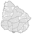
File:Mapa de Uruguay (subdivisiones).svg
Appearance

Size of this PNG preview of this SVG file: 563 × 599 pixels. Other resolutions: 225 × 240 pixels | 451 × 480 pixels | 722 × 768 pixels | 962 × 1,024 pixels | 1,924 × 2,048 pixels | 966 × 1,028 pixels.
Original file (SVG file, nominally 966 × 1,028 pixels, file size: 831 KB)
File history
Click on a date/time to view the file as it appeared at that time.
| Date/Time | Thumbnail | Dimensions | User | Comment | |
|---|---|---|---|---|---|
| current | 22:03, 24 May 2021 |  | 966 × 1,028 (831 KB) | Milenioscuro | actualizo y corrijo limites |
| 22:00, 24 May 2021 |  | 1,000 × 1,056 (2.04 MB) | Milenioscuro | Reverted to version as of 09:42, 3 September 2015 (UTC) | |
| 22:00, 24 May 2021 |  | 966 × 1,028 (791 KB) | Milenioscuro | actualizo y corrijo limites | |
| 09:42, 3 September 2015 |  | 1,000 × 1,056 (2.04 MB) | Milenioscuro | User created page with UploadWizard |
File usage
The following page uses this file:
Global file usage
The following other wikis use this file:
