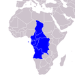
File:Mapa CEEAC.PNG
Appearance

Size of this preview: 515 × 599 pixels. Other resolutions: 206 × 240 pixels | 412 × 480 pixels | 660 × 768 pixels.
Original file (660 × 768 pixels, file size: 33 KB, MIME type: image/png)
File history
Click on a date/time to view the file as it appeared at that time.
| Date/Time | Thumbnail | Dimensions | User | Comment | |
|---|---|---|---|---|---|
| current | 13:34, 14 December 2018 |  | 660 × 768 (33 KB) | Fobos92 | Mapa de mejor calidad. |
| 15:52, 9 July 2011 |  | 360 × 392 (12 KB) | Maphobbyist | South Sudan has become independent on July 9, 2011. Sudan and South Sudan are shown with the new international border between them. | |
| 12:42, 20 December 2007 |  | 360 × 392 (12 KB) | Gurgut | {{Information |Description=Mapa de los países integrantes de la CEEAC/ ECCAS map |Source=self-made, colouring this file from wikicommons: Africa-countries-CEMAC.png |Date= 20 diciembre 2007 |Author= Gurgut |Permission= |other_versions= }} |
File usage
The following page uses this file:
Global file usage
The following other wikis use this file:
- Usage on ar.wikipedia.org
- Usage on ca.wikipedia.org
- Usage on el.wikipedia.org
- Usage on es.wikipedia.org
- Usage on fr.wikinews.org
- Usage on fy.wikipedia.org
- Usage on it.wikipedia.org
- Usage on ko.wikipedia.org
- Usage on no.wikipedia.org
- Usage on rw.wikipedia.org
- Usage on te.wikipedia.org

