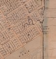
File:Map showing creek flowing through Frog's Hollow, 1863.jpg
Appearance

Size of this preview: 574 × 600 pixels. Other resolutions: 230 × 240 pixels | 460 × 480 pixels | 1,010 × 1,055 pixels.
Original file (1,010 × 1,055 pixels, file size: 176 KB, MIME type: image/jpeg)
File history
Click on a date/time to view the file as it appeared at that time.
| Date/Time | Thumbnail | Dimensions | User | Comment | |
|---|---|---|---|---|---|
| current | 05:09, 5 July 2021 |  | 1,010 × 1,055 (176 KB) | Kerry Raymond | Uploaded a work by Thomas Ham, engraver, lithographer and publisher (1821–1870) from Crop of [https://gisservices.information.qld.gov.au/arcgis/rest/directories/historicalscans/cad_scans/cad-map-brisbane-buxton-and-ham-1863.jpg Thomas Ham's 1863 map of Brisbane] showing the creek flowing through Frog's Hollow in Brisbane's central business district with UploadWizard |
File usage
The following page uses this file:

