Jump to content

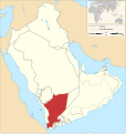
File:Map of the states of the Arabian Peninsula (1905-1923).svg

Page contents not supported in other languages.
This is a file from the Wikimedia Commons
From Wikipedia, the free encyclopedia

Original file (SVG file, nominally 1,162 × 1,225 pixels, file size: 1.36 MB)

Summary

Description
English: Map of the states of the arabian peninsula
Date
Source

Own work based on:
خريطة أهم دول و سلاطين الجزيرة العربية و قبائل قبل 100سنه.jpg by أماراتي
Maps template-en.svg by Sting
BlankMap-World gray.svg by LivingShadow
Own work using: OpenStreetMap

Author Goran_tek-en
Permission
(Reusing this file)
w:en:Creative Commons
attribution share alike
This file is licensed under the Creative Commons Attribution-Share Alike 4.0 International license.
Attribution: Goran_tek-en
You are free:
  • to share – to copy, distribute and transmit the work
  • to remix – to adapt the work
Under the following conditions:
  • attribution – You must give appropriate credit, provide a link to the license, and indicate if changes were made. You may do so in any reasonable manner, but not in any way that suggests the licensor endorses you or your use.
  • share alike – If you remix, transform, or build upon the material, you must distribute your contributions under the same or compatible license as the original.
This work contains information from OpenStreetMap, which is made available under the Open Database License (ODbL).

The ODbL does not require any particular license for maps produced from ODbL data. Prior to 1 August 2020, map tiles produced by the OpenStreetMap Foundation were licensed under the CC-BY-SA-2.0 license. Maps produced by other people may be subject to other licences.

Other versions
SVG development
InfoField
 
The SVG code is valid.
 
This vector image was created with Inkscape.
Object location25° 04′ 55.2″ N, 45° 53′ 49.2″ E Kartographer map based on OpenStreetMap.View this and other nearby images on: OpenStreetMapinfo

Captions

Map of the states of the arabian peninsula 1923

Items portrayed in this file

depicts

10 December 2023

image/svg+xml

3a2e8bad94ee5a3ce0b8c003c81d2a1cec2ca919

1,420,976 byte

1,225 pixel

1,162 pixel

25°4'55.200"N, 45°53'49.200"E

File history

Click on a date/time to view the file as it appeared at that time.

Date/TimeThumbnailDimensionsUserComment
current15:45, 10 December 2023Thumbnail for version as of 15:45, 10 December 20231,162 × 1,225 (1.36 MB)Goran tek-en{{Information |description ={{en|Map of the states of the arabian peninsula}} {{Institution |wikidata=Qx}} |date =2023-12-10 |source ={{Own based|خريطة أهم دول و سلاطين الجزيرة العربية و قبائل قبل 100سنه.jpg|Maps template-en.svg|BlankMap-World gray.svg|b1=أماراتي|b2=Sting|b3=LivingShadow}} <br> {{own using}} [https://www.openstreetmap.org/#map=8/29.814/39.430 OpenStreetMap]<br> *Requested by and knowledge from {{U|Abo Yemen}} |author =[[User:Goran tek-en|Gora...

The following page uses this file:

Metadata