
File:Map of the State of North Carolina showing the gold region 1847.jpg
Size of this preview: 708 × 599 pixels. Other resolutions: 284 × 240 pixels | 567 × 480 pixels | 907 × 768 pixels | 1,210 × 1,024 pixels | 2,419 × 2,048 pixels | 4,387 × 3,714 pixels.
Original file (4,387 × 3,714 pixels, file size: 2.91 MB, MIME type: image/jpeg)
| This is a file from the Wikimedia Commons. Information from its description page there is shown below. Commons is a freely licensed media file repository. You can help. |
Summary
| Description |
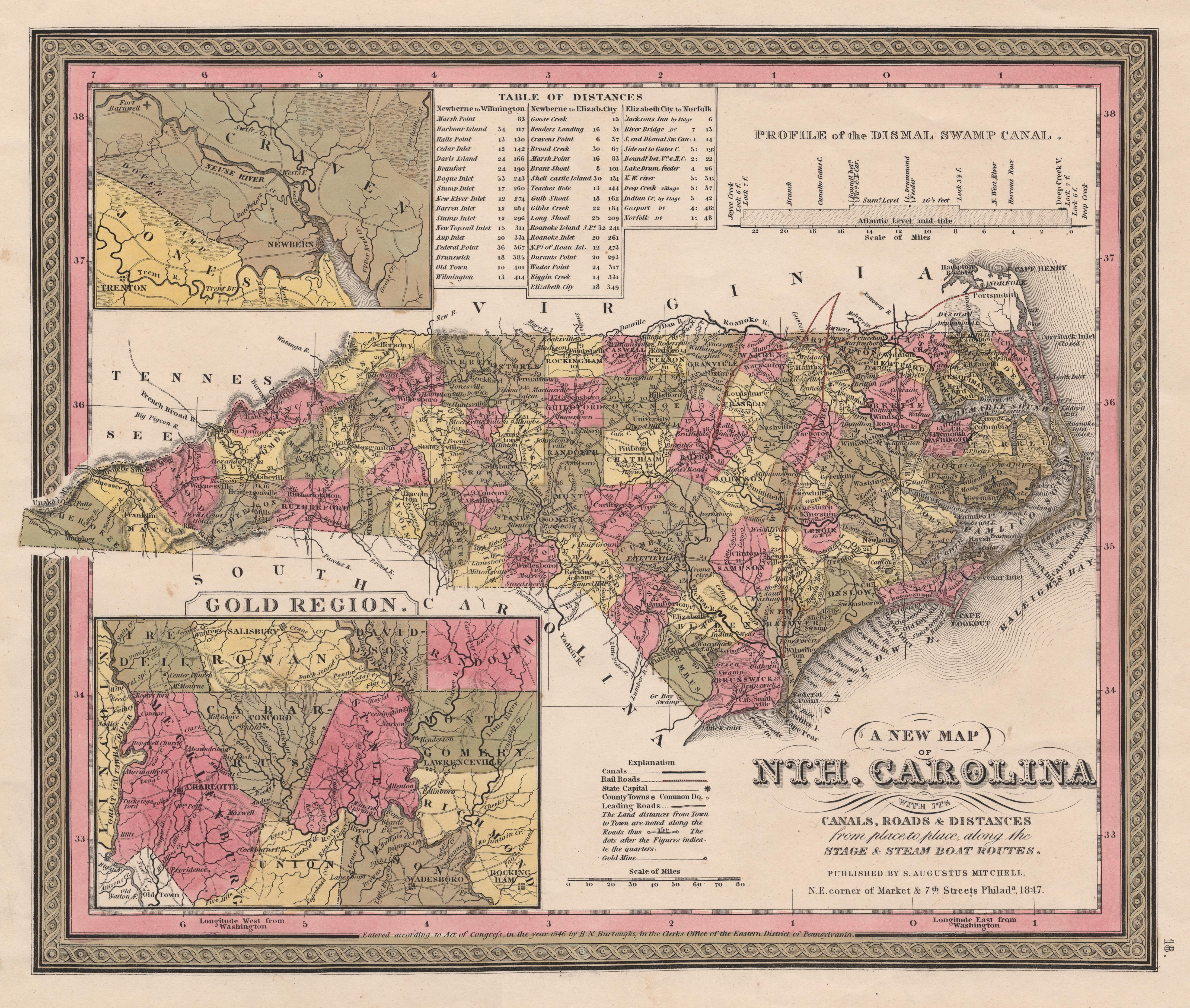
English: Map of the state of North Carolina showing the gold region of the state, 1847. Image courtesy of learnnc.org. |
| Date | |
| Source | http://www.learnnc.org/lp/multimedia/10025 |
| Author | Unknown author |
| Other versions |
|


Licensing
This media file is in the public domain in the United States. This applies to U.S. works where the copyright has expired, often because its first publication occurred prior to January 1, 1929, and if not then due to lack of notice or renewal. See this page for further explanation.
|
 | |
 |
File history
Click on a date/time to view the file as it appeared at that time.
| Date/Time | Thumbnail | Dimensions | User | Comment | |
|---|---|---|---|---|---|
| current | 04:11, 16 June 2010 | | 4,387 × 3,714 (2.91 MB) | MarmadukePercy | {{Information |Description={{en|1=Map of the state of North Carolina showing the gold region of the state, 1847. Image courtesy of learnnc.org.}} |Source=http://www.learnnc.org/lp/multimedia/10025 |Author=unknown |Date=1847 |Permission= |other_versions= } |
File usage
The following page uses this file: