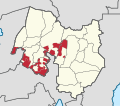
File:Map of the Special Geographic Area (Bangsamoro).svg
Appearance

Size of this PNG preview of this SVG file: 173 × 153 pixels. Other resolutions: 271 × 240 pixels | 543 × 480 pixels | 868 × 768 pixels | 1,158 × 1,024 pixels | 2,316 × 2,048 pixels.
Original file (SVG file, nominally 173 × 153 pixels, file size: 6.89 MB)
File history
Click on a date/time to view the file as it appeared at that time.
| Date/Time | Thumbnail | Dimensions | User | Comment | |
|---|---|---|---|---|---|
| current | 11:26, 11 March 2023 |  | 173 × 153 (6.89 MB) | Hariboneagle927 | Bgy. Dunguan |
| 14:33, 5 March 2023 |  | 173 × 153 (6.89 MB) | Hariboneagle927 | missiing municipality | |
| 14:12, 5 March 2023 |  | 173 × 153 (6.89 MB) | Hariboneagle927 | Uploaded a work by {{own work}} based on {{U|Hellerick}}'s File:Philippines location map (square).svg from ;NAMRIA Topographical Map / Bureau of Soils and Water Management *[http://bswm.da.gov.ph/wp-content/uploads/north-cotabato-k-corn-ConvertImage-scaled.jpg North Cotabato Map] ;Bangsamoro Parliament Bill: *[https://parliament.bangsamoro.gov.ph/wp-content/uploads/2022/12/Bill-No.-130-Government-of-the-day-AN-ACT-CREATING-THE-MUNICIPALITY-OF-K... |
File usage
The following 2 pages use this file:
Global file usage
The following other wikis use this file:
- Usage on bcl.wikipedia.org

