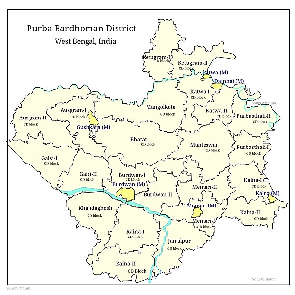
File:Map of purba bardhaman district.jpg
Appearance

Size of this preview: 600 × 600 pixels. Other resolutions: 240 × 240 pixels | 480 × 480 pixels | 768 × 768 pixels | 1,024 × 1,024 pixels | 1,700 × 1,700 pixels.
Original file (1,700 × 1,700 pixels, file size: 763 KB, MIME type: image/jpeg)
File history
Click on a date/time to view the file as it appeared at that time.
| Date/Time | Thumbnail | Dimensions | User | Comment | |
|---|---|---|---|---|---|
| current | 19:08, 27 April 2020 |  | 1,700 × 1,700 (763 KB) | Sgmanna | Cross-wiki upload from en.wikipedia.org |
File usage
The following 25 pages use this file:
- Ausgram I
- Bardhaman
- Bhatar (community development block)
- Burdwan I
- Burdwan II
- Galsi I
- Galsi II
- Jamalpur (community development block)
- Kalna I
- Kalna II
- Katwa I
- Katwa II
- Katwa subdivision
- Ketugram I
- Ketugram II
- Khandaghosh (community development block)
- Manteswar
- Memari I
- Memari II
- Mongalkote (community development block)
- Purba Bardhaman district
- Purbasthali I
- Purbasthali II
- Raina I
- Raina II
Global file usage
The following other wikis use this file:
- Usage on sat.wikipedia.org
