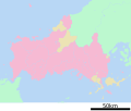
File:Map of Yamaguchi Prefecture Ja.svg
Appearance

Size of this PNG preview of this SVG file: 572 × 444 pixels. Other resolutions: 309 × 240 pixels | 619 × 480 pixels | 990 × 768 pixels | 1,280 × 994 pixels | 2,560 × 1,987 pixels.
Original file (SVG file, nominally 572 × 444 pixels, file size: 12 KB)
File history
Click on a date/time to view the file as it appeared at that time.
| Date/Time | Thumbnail | Dimensions | User | Comment | |
|---|---|---|---|---|---|
| current | 05:26, 15 July 2013 |  | 572 × 444 (12 KB) | ニンジンシチュー | Copied from ja:ファイル:包括自治体区画図 35000.svg |
| 13:58, 16 January 2010 |  | 572 × 444 (12 KB) | Lincun | {{基礎自治体位置図画像情報|山口県||20100116}} | |
| 18:26, 8 May 2008 |  | 624 × 528 (10 KB) | Krisgrotius | {{Information| |Description= Map of Yamaguchi Prefecture, Japan. |Source= Japanese wiki [http://ja.wikipedia.org/wiki/%E7%94%BB%E5%83%8F:%E5%8C%85%E6%8B%AC%E8%87%AA%E6%B2%BB%E4%BD%93%E5%8C%BA%E7%94%BB%E5%9B%B3_35000.svg] |Date=~~~~~ |Author=[[:ja: 利� | |
| 15:35, 26 March 2008 |  | 624 × 528 (10 KB) | Lincun | {{基礎自治体位置図画像情報|山口県|}} | |
| 12:26, 26 October 2007 |  | 780 × 682 (15 KB) | Lincun | {{基礎自治体位置図画像情報|山口県|}} |
File usage
The following page uses this file:
Global file usage
The following other wikis use this file:
- Usage on gl.wikipedia.org
- Usage on ja.wikipedia.org
- 山口県
- 関門橋
- 錦帯橋
- 山口宇部空港
- 広島東洋カープ由宇練習場
- 常盤公園 (宇部市)
- 上関原子力発電所
- 赤間神宮
- 長門湯本温泉
- 湯田温泉
- 防府天満宮
- 大島商船高等専門学校
- 防府競輪場
- 長府
- 勝山 (下関市)
- 玖珂町
- 山口県立厚狭高等学校
- 岩国飛行場
- 宇部工業高等専門学校
- 萩城
- 下関港
- 山口県立豊浦高等学校
- 下関商業高等学校
- 山口県立山口高等学校
- 山口県立宇部高等学校
- 梅光学院大学
- 山口県立萩高等学校
- 早鞆高等学校
- 山口県立宇部西高等学校
- 山口県立宇部中央高等学校
- 山口県鴻城高等学校
- 山口県立美術館
- 山口県立西京高等学校
- 長門高等学校
- 山口サビエル記念聖堂
- 山口県立山口博物館
- 功山寺
- 大寧寺
- 木戸峠
- 玉祖神社
- 宇部伊佐専用道路
- シーモール下関
- 火の山公園
- 宇部フロンティア大学付属中学校・香川高等学校
- 維新百年記念公園
- 豊榮神社・野田神社
- 小月航空基地
- 山口県桜ケ丘高等学校・晃英館中学校
- 笠山
View more global usage of this file.

