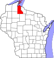
File:Map of Wisconsin highlighting Ashland County.svg
Appearance

Size of this PNG preview of this SVG file: 560 × 600 pixels. Other resolutions: 224 × 240 pixels | 448 × 480 pixels | 717 × 768 pixels | 956 × 1,024 pixels | 1,912 × 2,048 pixels | 1,055 × 1,130 pixels.
Original file (SVG file, nominally 1,055 × 1,130 pixels, file size: 70 KB)
File history
Click on a date/time to view the file as it appeared at that time.
| Date/Time | Thumbnail | Dimensions | User | Comment | |
|---|---|---|---|---|---|
| current | 10:44, 25 June 2024 |  | 1,055 × 1,130 (70 KB) | Nux | fix rendering (remove clipping) |
| 00:21, 13 February 2006 |  | 4,747 × 5,087 (103 KB) | David Benbennick | {{subst:User:Dbenbenn/clm|county=Ashland County|state=Wisconsin|type=county}} | |
| 18:13, 12 February 2006 |  | 4,747 × 5,087 (103 KB) | David Benbennick | {{subst:User:Dbenbenn/clm|county=Ashland County|state=Wisconsin|type=county}} |
File usage
The following 69 pages use this file:
- Agenda, Wisconsin
- Ashland, Wisconsin
- Ashland (town), Wisconsin
- Ashland County, Wisconsin
- Bad River Band of the Lake Superior Tribe of Chippewa Indians
- Ballou, Wisconsin
- Bayfront, Wisconsin
- Bayport, Wisconsin
- Bear Island (Wisconsin)
- Beartrap Creek
- Birch, Ashland County, Wisconsin
- Birch Hill, Wisconsin
- Butternut, Wisconsin
- Cat Island (Wisconsin)
- Chequamegon Point
- Chippewa, Wisconsin
- Clam Lake, Wisconsin
- Diaperville, Wisconsin
- Foster Junction, Wisconsin
- Franks Field, Wisconsin
- Gingles, Wisconsin
- Glidden, Wisconsin
- Gordon, Ashland County, Wisconsin
- Gull Island (Wisconsin)
- Hermit Island (Wisconsin)
- Highbridge, Wisconsin
- Ironwood Island (Wisconsin)
- Jacobs, Wisconsin
- Jolmaville, Wisconsin
- Kakagon Sloughs
- La Pointe, Wisconsin
- La Pointe County, Wisconsin
- List of counties in Wisconsin
- Long Island (Wisconsin)
- Madeline Island
- Manitou Island (Wisconsin)
- Marengo, Wisconsin
- Marengo (CDP), Wisconsin
- Mellen, Wisconsin
- Michigan Island
- Morse, Wisconsin
- Morse (community), Wisconsin
- National Register of Historic Places listings in Ashland County, Wisconsin
- New Odanah, Wisconsin
- North Twin Island (Wisconsin)
- North York, Wisconsin
- Oak Island (Wisconsin)
- Odanah, Wisconsin
- Otter Island (Wisconsin)
- Outer Island (Wisconsin)
- Peeksville, Wisconsin
- Penokee, Wisconsin
- Rocky Island (Wisconsin)
- Rocky Island Historic District
- Sanborn, Wisconsin
- Shanagolden, Wisconsin
- Shanagolden (community), Wisconsin
- South Twin Island (Wisconsin)
- Stockton Island
- Swamp Creek (Wisconsin)
- White River, Wisconsin
- Talk:Highbridge, Wisconsin
- User:DNOVAK25/sandbox
- User:Nyttend/County templates/WI
- User:Rfc1394/sandbox2
- File talk:Map of Wisconsin highlighting Ashland County.svg
- Template:AshlandCountyWI-geo-stub
- Template:Ashland County, Wisconsin
- Category:Populated places in Ashland County, Wisconsin
Global file usage
The following other wikis use this file:
- Usage on ar.wikipedia.org
- أجندا (ويسكونسن)
- أشلاند (ويسكونسن)
- شبوا (ويسكونسن)
- غينغليس (ويسكونسن)
- غوردون (مقاطعة آشلاند)
- جاكوبز (ويسكونسن)
- لا بوينت (ويسكونسن)
- مارينغو (ويسكونسن)
- مورس (ويسكونسن)
- بيكسفيل (ويسكونسن)
- سانبورن (ويسكونسن)
- شاناغولدن (ويسكونسن)
- وايت ريفر (ويسكونسن)
- مقاطعة آشلاند (ويسكونسن)
- آشلاند (ويسكونسن)
- ميلين (ويسكونسن)
- باترنات (ويسكونسن)
- قالب:مقاطعة آشلاند (ويسكونسن)
- Usage on bg.wikipedia.org
- Usage on bpy.wikipedia.org
- Usage on cdo.wikipedia.org
- Usage on ceb.wikipedia.org
- Usage on ce.wikipedia.org
- Usage on cy.wikipedia.org
- Usage on de.wikipedia.org
- Usage on eo.wikipedia.org
- Usage on es.wikipedia.org
- Usage on et.wikipedia.org
- Usage on eu.wikipedia.org
- Usage on fa.wikipedia.org
- آشلند، ویسکانسین
- میلن، ویسکانسین
- اجندا، ویسکانسین
- شهرستان اشلند، ویسکانسین
- اودانا، ویسکانسین
- لا پوینت، ویسکانسین
- گلیدن، ویسکانسین
- بیرچ هیل، ویسکانسین
- فرنکس فیلد، ویسکانسین
- دیاپرویل، ویسکانسین
- کلم لیک، ویسکانسین
- نیواودانا، ویسکانسین
- مرنگو (حوزه سرشماری)، ویسکانسین
- بریچ، شهرستان اشلند، ویسکانسین
- نورث یورک، ویسکانسین
View more global usage of this file.
