
File:Map of Villaluenga del Rosario (Cádiz).png
No higher resolution available.
Map_of_Villaluenga_del_Rosario_(Cádiz).png (326 × 320 pixels, file size: 25 KB, MIME type: image/png)
| This is a file from the Wikimedia Commons. Information from its description page there is shown below. Commons is a freely licensed media file repository. You can help. |
.png)
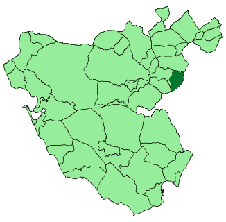
Title
- Español: Situación del municipio de Villaluenga del Rosario (Cádiz).
- English: Situation of the municipality of Villaluenga del Rosario (Cádiz).
- This image is based on Image:Map of Cádiz (Spain).PNG, which is a part of Image:Andalucia municipalities.png.
.PNG)

|
Permission is granted to copy, distribute and/or modify this document under the terms of the GNU Free Documentation License, Version 1.2 or any later version published by the Free Software Foundation; with no Invariant Sections, no Front-Cover Texts, and no Back-Cover Texts. A copy of the license is included in the section entitled GNU Free Documentation License. |
| This file is licensed under the Creative Commons Attribution-Share Alike 3.0 Unported license. | ||
| ||
| This licensing tag was added to this file as part of the GFDL licensing update. |
File history
Click on a date/time to view the file as it appeared at that time.
| Date/Time | Thumbnail | Dimensions | User | Comment | |
|---|---|---|---|---|---|
| current | 19:34, 15 August 2005 | | 326 × 320 (25 KB) | Loqu | '''Title''' :'''es:''' Situación del municipio de Villaluenga del Rosario (Cádiz). :'''en:''' Situation of the municipality of Villaluenga del Rosario (Cádiz). :This image is based on [http://commons.wikimedia.org/wiki/Image:Map_of_Cádiz_(Spain).PNG |
File usage
The following page uses this file:
Global file usage
The following other wikis use this file:
- Usage on ar.wikipedia.org
- Usage on arz.wikipedia.org
- Usage on ast.wikipedia.org
- Usage on ca.wikipedia.org
- Usage on ceb.wikipedia.org
- Usage on eo.wikipedia.org
- Usage on eu.wikipedia.org
- Usage on gl.wikipedia.org
- Usage on hu.wikipedia.org
- Usage on hy.wikipedia.org
- Usage on ia.wikipedia.org
- Usage on ie.wikipedia.org
- Usage on it.wikipedia.org
- Usage on lmo.wikipedia.org
- Usage on pt.wikipedia.org
- Usage on ro.wikipedia.org
- Usage on sv.wikipedia.org
- Usage on tr.wikipedia.org
- Usage on tt.wikipedia.org
- Usage on uk.wikipedia.org
- Usage on vi.wikipedia.org
- Usage on www.wikidata.org
- Usage on zh-min-nan.wikipedia.org
- Usage on zh.wikipedia.org
.png)