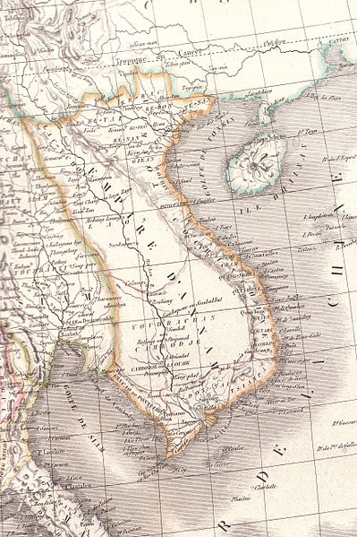
File:Map of Vietnam 1829.jpg
Appearance

Size of this preview: 399 × 599 pixels. Other resolutions: 160 × 240 pixels | 320 × 480 pixels | 511 × 768 pixels | 682 × 1,024 pixels | 1,364 × 2,048 pixels | 3,464 × 5,200 pixels.
Original file (3,464 × 5,200 pixels, file size: 8.83 MB, MIME type: image/jpeg)
File history
Click on a date/time to view the file as it appeared at that time.
| Date/Time | Thumbnail | Dimensions | User | Comment | |
|---|---|---|---|---|---|
| current | 06:23, 26 April 2010 |  | 3,464 × 5,200 (8.83 MB) | Duyet-pho | {{Information |Description={{en|1=Plate 35E "Carte de l’Inde endeca et audela du Gange" from Lapie's ''Atlas Universel'' printed in 1829}} |Source=Atlas Universel |Author=Pierre M. Lapie |Date= |Permission={{PD-1923}} |other_versions= }} [[Category:Map |
File usage
The following 2 pages use this file:
Global file usage
The following other wikis use this file:
- Usage on ca.wikipedia.org
- Usage on eu.wikipedia.org
- Usage on gl.wikipedia.org
- Usage on id.wikipedia.org
- Usage on it.wikipedia.org
- Usage on pt.wikipedia.org
- Usage on ru.wikipedia.org
- Usage on th.wikipedia.org
- Usage on tr.wikipedia.org
- Usage on vi.wikipedia.org
- Usage on www.wikidata.org
- Usage on zh-min-nan.wikipedia.org
- Usage on zh-yue.wikipedia.org
