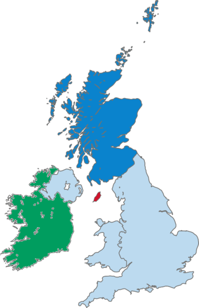
File:Map of Scotland within the United Kingdom.png
Appearance

Size of this preview: 387 × 600 pixels. Other resolutions: 155 × 240 pixels | 500 × 775 pixels.
Original file (500 × 775 pixels, file size: 99 KB, MIME type: image/png)
File history
Click on a date/time to view the file as it appeared at that time.
| Date/Time | Thumbnail | Dimensions | User | Comment | |
|---|---|---|---|---|---|
| current | 10:07, 16 January 2020 |  | 500 × 775 (99 KB) | Kontrollstellekundl | isle of man without colour = not ireland !!! |
| 18:09, 14 August 2005 |  | 290 × 396 (44 KB) | Wighson | Updated map to reflect Scottish (blue pantone) rather than English (royal red) colors. This shows the Hebrides. | |
| 02:44, 7 May 2005 |  | 200 × 246 (7 KB) | Neutrality | Created by Morwen. {{GFDL}} |
File usage
The following 3 pages use this file:
Global file usage
The following other wikis use this file:
- Usage on de.wikipedia.org
- Usage on it.wikipedia.org
- Usage on lmo.wikipedia.org
- Usage on pl.wiktionary.org
- Usage on pms.wikipedia.org
- Usage on qu.wikipedia.org
- Usage on tr.wikinews.org


