Jump to content

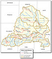
File:Map of Saline River.jpg

Page contents not supported in other languages.
This is a file from the Wikimedia Commons
From Wikipedia, the free encyclopedia

Original file (768 × 870 pixels, file size: 380 KB, MIME type: image/jpeg)

Summary

Description
English: Map of Saline River
Date
Source

http://www.il.nrcs.usda.gov/technical/rwa/es_salineriver.html

Transferred from en.wikipedia to Commons by User:Quadell using CommonsHelper.
Author NRCS department of the USDA

Licensing

Public domain
This image or file is a work of a United States Department of Agriculture employee, taken or made as part of that person's official duties. As a work of the U.S. federal government, the image is in the public domain.

English  español  Nederlands  slovenščina  Tiếng Việt  македонски  русский  українська  日本語  +/−

Original upload log

The original description page was here. All following user names refer to en.wikipedia.
  • 2009-06-20 06:41 Ruhe1986 768×870× (389429 bytes) {{Information |Description = Map of Saline River |Source = USGS |Date = |Author = USGS |Permission = |other_versions = }}

Captions

Add a one-line explanation of what this file represents

Items portrayed in this file

depicts

20 June 2009

File history

Click on a date/time to view the file as it appeared at that time.

Date/TimeThumbnailDimensionsUserComment
current14:36, 8 September 2011Thumbnail for version as of 14:36, 8 September 2011768 × 870 (380 KB)File Upload Bot (Magnus Manske) {{BotMoveToCommons|en.wikipedia|year={{subst:CURRENTYEAR}}|month={{subst:CURRENTMONTHNAME}}|day={{subst:CURRENTDAY}}}} {{Information |Description={{en|Map of en:Saline River (Illinois)}} |Source=Transferred from [http://en.wikipedia.org en.wikipedi

The following 2 pages use this file:

Global file usage

The following other wikis use this file:

Metadata