
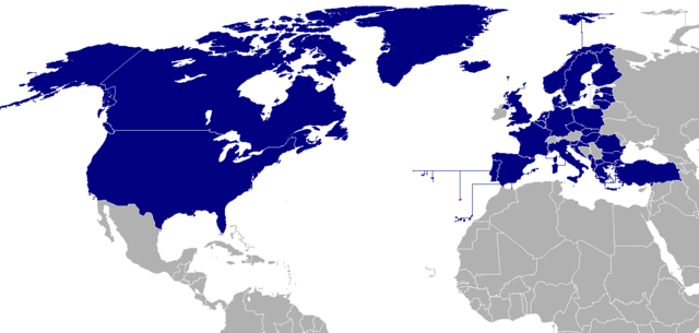
File:Map of NATO countries.png

Size of this preview: 800 × 381 pixels. Other resolutions: 320 × 152 pixels | 640 × 305 pixels | 1,404 × 668 pixels.
Original file (1,404 × 668 pixels, file size: 23 KB, MIME type: image/png)
| This is a file from the Wikimedia Commons. Information from its description page there is shown below. Commons is a freely licensed media file repository. You can help. |

|
File:NATO members (blue).svg is a vector version of this file. It should be used in place of this PNG file when not inferior.
File:Map of NATO countries.png → File:NATO members (blue).svg
For more information, see Help:SVG. |
Summary
| Description | |||||||||
| Source | taken from the English Wikipedia. | ||||||||
| Author | The image was originally made by User:Donarreiskoffer. This version (corrected regarding Northern Ireland) is identical (except the size) to one uploaded by en:User:Mrowlinson which didn't have a copyright license. | ||||||||
| Permission (Reusing this file) |
|

.svg)
File history
Click on a date/time to view the file as it appeared at that time.
| Date/Time | Thumbnail | Dimensions | User | Comment | |
|---|---|---|---|---|---|
| current | 18:37, 7 March 2024 | | 1,404 × 668 (23 KB) | Iktsokh | Sweden |
| 12:29, 5 April 2023 |  | 1,404 × 668 (43 KB) | TheThomanski | Finland | |
| 12:25, 23 October 2021 |  | 1,404 × 668 (66 KB) | Dylmur | Changed blue dot near Panama to gray | |
| 09:36, 2 August 2021 |  | 1,404 × 668 (66 KB) | Dylmur | Making Cape Verde and Liechtenstein gray as they aren’t members of NATO | |
| 09:31, 2 August 2021 |  | 1,404 × 668 (66 KB) | Dylmur | Reverted to version as of 23:52, 31 July 2021 (UTC) | |
| 09:30, 2 August 2021 |  | 1,404 × 668 (370 KB) | Dylmur | Cape Verde is not a member of NATO | |
| 23:52, 31 July 2021 |  | 1,404 × 668 (66 KB) | Dylmur | Proper PNG | |
| 05:27, 22 May 2020 |  | 800 × 381 (105 KB) | TheFallen97 | French Guiana not part of North Atlantic Treaty. | |
| 09:39, 28 March 2020 |  | 1,404 × 668 (70 KB) | Dylmur | Reverted to version as of 09:38, 28 March 2020 (UTC) hope it works again | |
| 09:38, 28 March 2020 |  | 1,404 × 668 (44 KB) | Dylmur | Reverted to version as of 06:57, 27 September 2018 (UTC) |
File usage
The following 3 pages use this file:
Global file usage
The following other wikis use this file:
- Usage on fr.wikinews.org
- Usage on pl.wiktionary.org
- Usage on ru.wikipedia.org