
File:Map of Maine highlighting Cumberland County.svg

Size of this PNG preview of this SVG file: 400 × 600 pixels. Other resolutions: 160 × 240 pixels | 320 × 480 pixels | 512 × 768 pixels | 683 × 1,024 pixels | 1,366 × 2,048 pixels | 723 × 1,084 pixels.
Original file (SVG file, nominally 723 × 1,084 pixels, file size: 71 KB)
| This is a file from the Wikimedia Commons. Information from its description page there is shown below. Commons is a freely licensed media file repository. You can help. |
Summary
| Description |
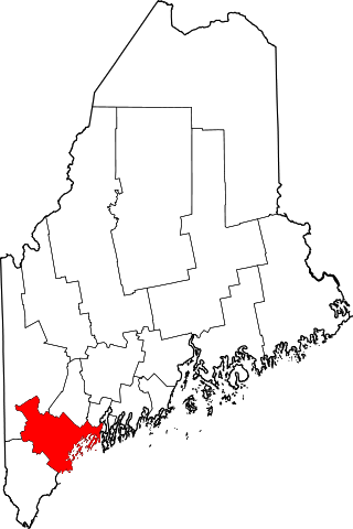
English: This is a locator map showing Cumberland County in Maine. For more information, see Commons:United States county locator maps. |
| Date | |
| Source |
Own work: English: The maps use data from nationalatlas.gov, specifically countyp020.tar.gz on the Raw Data Download page. The maps also use state outline data from statesp020.tar.gz. The Florida maps use hydrogm020.tar.gz to display Lake Okeechobee. |
| Author | David Benbennick |
Licensing
| I, the copyright holder of this work, release this work into the public domain. This applies worldwide. In some countries this may not be legally possible; if so: I grant anyone the right to use this work for any purpose, without any conditions, unless such conditions are required by law. |
File history
Click on a date/time to view the file as it appeared at that time.
| Date/Time | Thumbnail | Dimensions | User | Comment | |
|---|---|---|---|---|---|
| current | 21:32, 24 June 2024 | | 723 × 1,084 (71 KB) | Nux | fix rendering (remove clipping) |
| 12:46, 12 February 2006 |  | 3,252 × 4,876 (131 KB) | David Benbennick | {{subst:User:Dbenbenn/clm|county=Cumberland County|state=Maine|type=county}} |
File usage
The following 73 pages use this file:
- Bailey Island (Maine)
- Baldwin, Maine
- Bridgton, Maine
- Bridgton (CDP), Maine
- Brunswick, Maine
- Brunswick (CDP), Maine
- Brunswick Air Force Station
- Brunswick Executive Airport
- Brunswick Station, Maine
- Cape Elizabeth, Maine
- Casco, Maine
- Casco (CDP), Maine
- Chebeague Island
- Cousins Island
- Cumberland, Maine
- Cumberland Center, Maine
- Cumberland County, Maine
- Dunstan, Maine
- Falmouth, Maine
- Falmouth (CDP), Maine
- Falmouth Foreside
- Fort Levett
- Fort Preble
- Freeport, Maine
- Freeport, Maine (CDP)
- Frye Island, Maine
- Gorham, Maine
- Gorham (CDP), Maine
- Gray, Maine
- Gray (CDP), Maine
- Harpswell, Maine
- Harrison, Maine
- Higgins Beach
- List of counties in Maine
- Little Falls, Maine
- Little Falls-South Windham, Maine
- Littlejohn Island
- Long Island, Maine
- Naples, Maine
- Naples (CDP), Maine
- National Register of Historic Places listings in Cumberland County, Maine
- Naval Air Station Brunswick
- New Gloucester, Maine
- North Bridgton, Maine
- North Windham, Maine
- North Yarmouth, Maine
- Oak Hill, Maine
- Orr's Island
- Pine Point Beach
- Portland, Maine
- Pownal, Maine
- Prouts Neck
- Raymond, Maine
- Scarborough, Maine
- Sebago, Maine
- Sebago Lake, Maine
- South Casco, Maine
- South Freeport, Maine
- South Portland, Maine
- South Windham, Maine
- Standish, Maine
- Standish (CDP), Maine
- Steep Falls, Maine
- Topsham Air Force Station
- Westbrook, Maine
- Windham, Maine
- Yarmouth, Maine
- Yarmouth (CDP), Maine
- User:AridCeption/sandbox
- User:Nyttend/County templates/ME
- File talk:Map of Maine highlighting Cumberland County.svg
- Template:Cumberland County, Maine
- Category:Populated places in Cumberland County, Maine
Global file usage
The following other wikis use this file:
- Usage on ar.wikipedia.org
- بورتلاند (مين)
- مقاطعة كمبرلاند (مين)
- ساوث بورتلاند
- وستبروك
- كاب إليزابث (مين)
- كاسكو (مين)
- كومبرلاند (مين)
- فريبورت (مين)
- فراي أيلاند (مين)
- غورهام (مين)
- هاربسويل (مين)
- هاريسون (مين)
- نابلس (مين)
- نيو غلويسستر (مين)
- قائمة مقاطعات مين
- غراي (الولايات المتحدة)
- برونزويك (مين)
- نورث ويندهام (مين)
- كامبرلاند سنتر (مين)
- يارموث (مين)
- سكاربورو (مين)
- قالب:مقاطعة كمبرلاند (مين)
- Usage on be.wikipedia.org
- Usage on bg.wikipedia.org
- Usage on bpy.wikipedia.org
- Usage on ca.wikipedia.org
- Portland (Maine)
- Baldwin (Maine)
- Brunswick (Maine)
- Cape Elizabeth
- Casco (Maine)
- Cumberland (Maine)
- Falmouth (Maine)
- Freeport (Maine)
- Gorham (Maine)
- Gray (Maine)
- Harpswell
- Harrison (Maine)
- Long Island (Maine)
- Naples (Maine)
- New Gloucester
- North Yarmouth
- Pownal (Maine)
- Raymond (Maine)
- Scarborough (Maine)
- Sebago
- Standish (Maine)
- Westbrook (Maine)
- Windham (Maine)
View more global usage of this file.