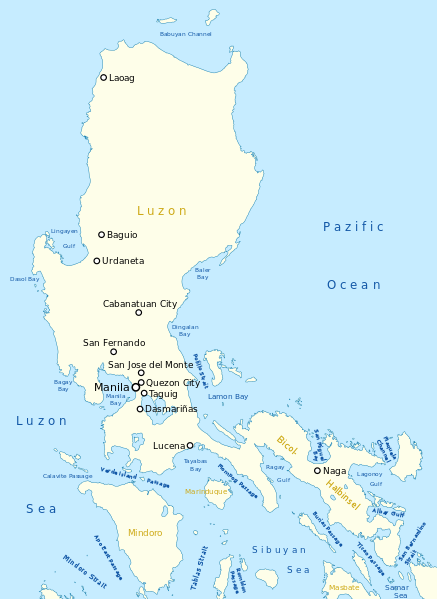
File:Map of Luzon Island.svg
Appearance

Size of this PNG preview of this SVG file: 437 × 599 pixels. Other resolutions: 175 × 240 pixels | 350 × 480 pixels | 560 × 768 pixels | 747 × 1,024 pixels | 1,493 × 2,048 pixels | 1,481 × 2,031 pixels.
Original file (SVG file, nominally 1,481 × 2,031 pixels, file size: 521 KB)
File history
Click on a date/time to view the file as it appeared at that time.
| Date/Time | Thumbnail | Dimensions | User | Comment | |
|---|---|---|---|---|---|
| current | 22:41, 5 November 2013 |  | 1,481 × 2,031 (521 KB) | Chumwa | == {{int:filedesc}} == {{Information |Description= {{de|Karte der Insel Luzon}} {{en|Map of Luzon Island}} |Source={{Own}}, using this map by {{U|NordNordWest}} |Date=see file history |Author= [[:de:User:Chumwa|Ma... |
File usage
The following page uses this file:
Global file usage
The following other wikis use this file:
- Usage on af.wikipedia.org
- Usage on cbk-zam.wikipedia.org
- Usage on cs.wikipedia.org
- Usage on de.wikipedia.org
- Usage on es.wikipedia.org
- Usage on frr.wikipedia.org
- Usage on fr.wikipedia.org
- Usage on ie.wikipedia.org
- Usage on ilo.wikipedia.org
- Usage on nl.wikipedia.org
- Usage on oc.wikipedia.org
- Usage on sk.wikipedia.org

