
File:Map of Essequibo and Demerara, 1798.jpg
Original file (4,027 × 2,709 pixels, file size: 1.03 MB, MIME type: image/jpeg)
| This is a file from the Wikimedia Commons. Information from its description page there is shown below. Commons is a freely licensed media file repository. You can help. |
Summary
| Description |
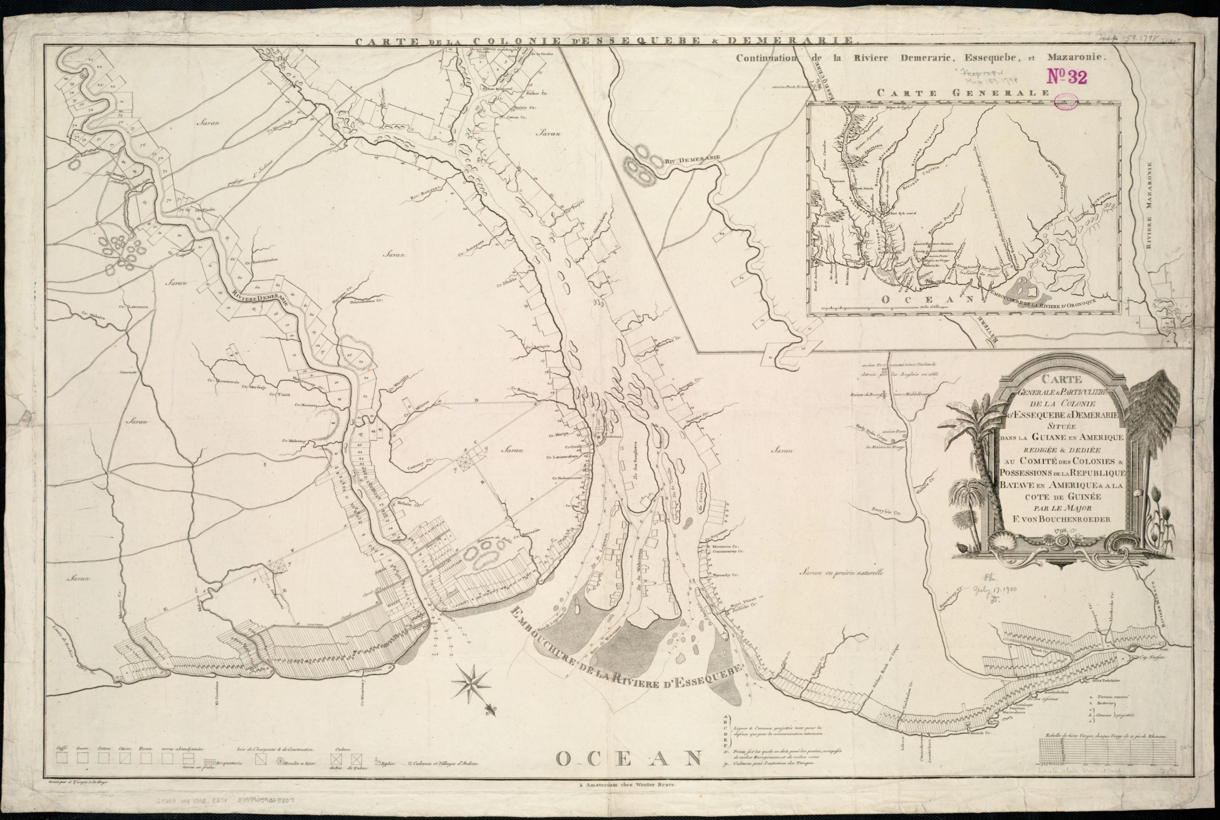
Zoom into this map at maps.bpl.org. Publisher: Brave, Wouter Date: 1798 Location: Demerara, Essequibo Dimension 62x97cm Scale: ca. 1:190,080 Call Number: G5253.W4 1798 .C37x |
| Date | |
| Source |
|
| Author | http://maps.bpl.org |
Licensing
|
This is a faithful photographic reproduction of an original two-dimensional work of art. The work of art itself is in the public domain for the following reason:
This digital reproduction has been released under the following licenses: This file is licensed under the Creative Commons Attribution 2.0 Generic license.
In many jurisdictions, faithful reproductions of two-dimensional public domain works of art are not copyrightable. The Wikimedia Foundation's position is that these works are not copyrightable in the United States (see Commons:Reuse of PD-Art photographs). In these jurisdictions, this work is actually in the public domain and the requirements of the digital reproduction's license are not compulsory. | ||||
| This image, originally posted to Flickr, was reviewed on February 8, 2011 by the administrator or reviewer File Upload Bot (Magnus Manske), who confirmed that it was available on Flickr under the stated license on that date. |
File history
Click on a date/time to view the file as it appeared at that time.
| Date/Time | Thumbnail | Dimensions | User | Comment | |
|---|---|---|---|---|---|
| current | 15:49, 18 January 2020 | | 4,027 × 2,709 (1.03 MB) | ZiaLater | Provided a more detailed map |
| 02:34, 8 February 2011 |  | 2,000 × 1,347 (2.3 MB) | File Upload Bot (Magnus Manske) | {{Information |Description=Zoom into [http://maps.bpl.org/id/14293 this map] at [http://maps.bpl.org maps.bpl.org]. Publisher: Brave, Wouter Date: 1798 Location: Demerara, Essequibo Dimension 62x97cm Scale: ca. 1:190,080 Call Number: G5253.W4 1798 .C37x |
File usage
Global file usage
The following other wikis use this file:
- Usage on ar.wikipedia.org
- Usage on be.wikipedia.org
- Usage on es.wikipedia.org
- Usage on fi.wikipedia.org
- Usage on hr.wikipedia.org
- Usage on it.wikipedia.org
- Usage on lt.wikipedia.org
- Usage on pl.wikipedia.org
- Usage on ru.wikipedia.org
- Usage on sh.wikipedia.org
- Usage on uk.wikipedia.org
- Usage on www.wikidata.org