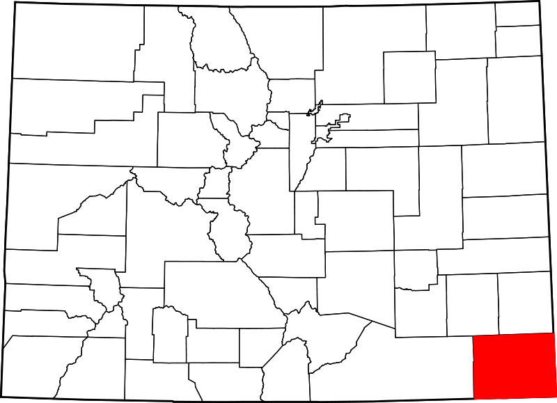
File:Map of Colorado highlighting Baca County.svg
Appearance

Size of this PNG preview of this SVG file: 800 × 579 pixels. Other resolutions: 320 × 232 pixels | 640 × 463 pixels | 1,024 × 741 pixels | 1,280 × 927 pixels | 2,560 × 1,853 pixels | 1,558 × 1,128 pixels.
Original file (SVG file, nominally 1,558 × 1,128 pixels, file size: 64 KB)
File history
Click on a date/time to view the file as it appeared at that time.
| Date/Time | Thumbnail | Dimensions | User | Comment | |
|---|---|---|---|---|---|
| current | 21:05, 24 June 2024 |  | 1,558 × 1,128 (64 KB) | Nux | fix rendering (remove clipping) |
| 05:42, 13 February 2006 |  | 6,234 × 4,511 (67 KB) | David Benbennick | New version, smaller file size |
File usage
The following 20 pages use this file:
- Baca County, Colorado
- Buckeye Crossroads, Colorado
- Campo, Colorado
- Deora, Colorado
- Edler, Colorado
- List of Colorado municipalities by county
- List of counties in Colorado
- Lycan, Colorado
- Pritchett, Colorado
- Springfield, Colorado
- Stonington, Colorado
- Two Buttes, Colorado
- Utleyville, Colorado
- Vilas, Colorado
- Walsh, Colorado
- User:AridCeption/sandbox
- User:Nyttend/County templates/CO
- File talk:Map of Colorado highlighting Baca County.svg
- Template:Baca County, Colorado
- Category:Populated places in Baca County, Colorado
Global file usage
The following other wikis use this file:
- Usage on ar.wikipedia.org
- Usage on be.wikipedia.org
- Usage on bg.wikipedia.org
- Usage on bpy.wikipedia.org
- Usage on ca.wikipedia.org
- Usage on cdo.wikipedia.org
- Usage on ceb.wikipedia.org
- Usage on ce.wikipedia.org
- Usage on cs.wikipedia.org
- Usage on cy.wikipedia.org
- Usage on de.wikipedia.org
- Usage on es.wikipedia.org
- Usage on et.wikipedia.org
- Usage on eu.wikipedia.org
- Usage on fa.wikipedia.org
- Usage on fi.wikipedia.org
- Usage on frr.wikipedia.org
- Usage on fr.wikipedia.org
- Usage on ga.wikipedia.org
View more global usage of this file.
