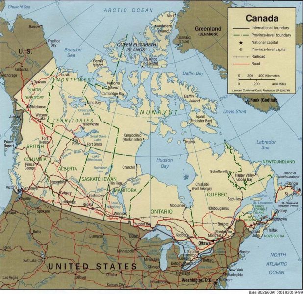
File:Map of Canada.jpg
Appearance

Size of this preview: 618 × 600 pixels. Other resolutions: 247 × 240 pixels | 495 × 480 pixels | 977 × 948 pixels.
Original file (977 × 948 pixels, file size: 244 KB, MIME type: image/jpeg)
File history
Click on a date/time to view the file as it appeared at that time.
| Date/Time | Thumbnail | Dimensions | User | Comment | |
|---|---|---|---|---|---|
| current | 08:58, 27 July 2006 |  | 977 × 948 (244 KB) | Frumpy | cropped |
| 05:29, 2 March 2006 |  | 1,050 × 1,030 (272 KB) | Leslie | Source: [http://www.lib.utexas.edu/maps/united_states Perry-Castañeda Library Map Collection] (a collection of maps where most are in public domain, see [http://www.lib.utexas.edu/usage_statement.html?maps=yes Library Web Material Usage Statement]. ''"C |
File usage
The following 3 pages use this file:
Global file usage
The following other wikis use this file:
- Usage on fa.wikipedia.org
- Usage on fi.wikipedia.org
- Usage on fr.wikipedia.org
- Usage on gom.wikipedia.org
- Usage on pt.wikipedia.org
- Usage on uk.wikipedia.org
